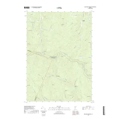
2018 Map of Delectable Mountain
USGS Topo · Published 2018About this map
Delectable Mtn and Burbee Peak anchor a high-elevation landscape where the Appalachian National Scenic Trail winds along the ridge through Notown. This section of the Green Mountains highlights a sparsely settled backcountry characterized by small hollows and isolated mountain peaks. The geography is defined by the headwaters of numerous streams, including Stony Brook and Fletcher Brook, which feed into the N Br Ottauquechee River near Chateauguay. Small local settlements like Bridgewater Hollow and Morgan Corners are connected by a network of winding roads such as Chateauguay Rd and Walker Hill Rd. Genealogy researchers may find interest in Nye Cem near Nyes Swamp, while landmarks such as The Gulf and The Lookout demonstrate the area's significance for long-distance hiking and local navigation.
Find a feature on this map
68 named features on this map. Tap any name to fly to it.
Don’t see what you’re looking for? This feature index may not catch every label — zoom into the map to look around manually.
Map Details
Editions of this 2018 Delectable Mountain Map
This is the sole edition of this map. No revisions or reprints were ever made.
Other maps of this area

1891 · Rutland
USGS Topo · 1:62,500

1893 · Rutland
USGS Topo · 1:62,500

1911 · Woodstock
USGS Topo · 1:62,500

1913 · Woodstock
USGS Topo · 1:62,500

1915 · Rochester
USGS Topo · 1:62,500

1917 · Rochester
USGS Topo · 1:62,500

1919 · Royalton
USGS Topo · 1:62,500

1924 · Randolph
USGS Topo · 1:48,000

1926 · Randolph
USGS Topo · 1:62,500

1943 · Woodstock
USGS Topo · 1:62,500