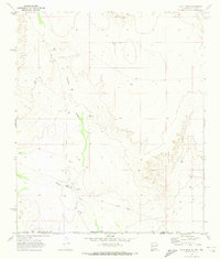
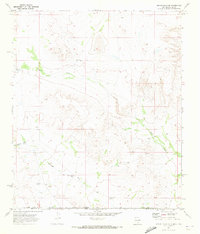
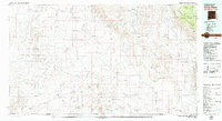
1984 Map of Dell City
USGS Topo · Published 1985About this map
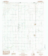
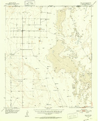
Dell City stands as a focal point of human activity in this corner of the northern Trans-Pecos, situated just south of the boundary between New Mexico and Texas. The landscape is defined by the heavy infrastructure of desert agriculture, characterized by a network of water management features such as the Irrigation Ditch, several Check Dams, and Sewage Disposal Ponds. The town itself is well-developed with community facilities including Athletic Fields, a Rodeo Ground, and even a Swimming Pool, suggesting a established residential center in the 1980s. To the south, the terrain descends toward the arid beds of Linda Lake and a Dry Lake, while the local topography is broken by the Wilcox Hills and the distinct prominence of Round Mountain. This provisional survey documents the intersection of rural industry and town life, from the Airport and multiple Landing Strips to the scattered Feed Lots and Corrals that dot the surrounding area.
Find a feature on this map
20 named features on this map. Tap any name to fly to it.
Don’t see what you’re looking for? This feature index may not catch every label — zoom into the map to look around manually.
Map Details
Editions of this 1984 Dell City Map
This is the sole edition of this map. No revisions or reprints were ever made.
Other maps of this area
1951 · Dell City
USGS Topo · 1:62,500

1954 · Carlsbad
USGS Topo · 1:250,000

1954 · Van Horn
USGS Topo · 1:250,000
1955 · Cerro Diablo
USGS Topo · 1:62,500

1958 · Van Horn
USGS Topo · 1:250,000

1958 · Carlsbad
USGS Topo · 1:250,000
1969 · Cienega School
USGS Topo · 1:24,000
1969 · Culp Draw
USGS Topo · 1:24,000
1970 · Shiloh Hills SE
USGS Topo · 1:24,000
1979 · Crow Flats
USGS Topo · 1:100,000