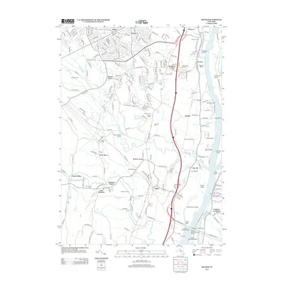
2013 Map of Delmar
USGS Topo · Published 2013About this map
Delmar and Elsmere anchor the suburban landscape of Albany County in this 2013 survey, where the established residential patterns of Bethlehem Center meet the industrial and transit corridors of the Hudson River. The area is characterized by a dense concentration of local history markers, including the Bethlehem Cem, Beth Emeth Cem, and Mt Pleasant Cem. The riverfront is dominated by large islands and hooks such as Schermerhorn Island and Paarda Hook, intersected by significant engineering works like the Castleton-on-Hudson Bridge and the Alfred H Smith Memorial Bridge. Local aviation is represented by South Albany Airport and Cross' Farm Airport, while the Jericho Drive-In remains a distinctive cultural landmark near Meyers Corners. The network of small waterways, including Vloman Kill and Dowers Kill, reveals the natural drainage patterns that shaped early settlement at South Albany and Beckers Corners.
Find a feature on this map
70 named features on this map. Tap any name to fly to it.
Don’t see what you’re looking for? This feature index may not catch every label — zoom into the map to look around manually.
Map Details
Editions of this 2013 Delmar Map
This is the sole edition of this map. No revisions or reprints were ever made.
Other maps of this area

1893 · Troy
USGS Topo · 1:62,500

1893 · Coxsackie
USGS Topo · 1:62,500

1893 · Albany
USGS Topo · 1:62,500

1894 · Coxsackie
USGS Topo · 1:62,500

1895 · Troy
USGS Topo · 1:62,500

1895 · Albany
USGS Topo · 1:62,500

1898 · Albany
USGS Topo · 1:62,500

1898 · Troy
USGS Topo · 1:62,500

1903 · Kinderhook
USGS Topo · 1:62,500

1925 · Troy
USGS Topo · 1:48,000