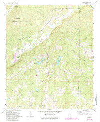
1970 Map of Delta
USGS Topo · Published 1985About this map
The rugged topography of the Talladega National Forest dominates this section of eastern Alabama, where the rising elevation of Shinbone Ridge overlooks a landscape defined by creeks and small rural communities. The settlement of Delta serves as a central point, situated near water bodies like Clay County Lake and Lake Gerald. This 1970s survey, with later revisions, shows a social fabric woven through numerous rural landmarks, including Ragan Chapel and Haynes Crossroad.
Find a feature on this map
36 named features on this map. Tap any name to fly to it.
Don’t see what you’re looking for? This feature index may not catch every label — zoom into the map to look around manually.
Map Details
Editions of this 1970 Delta Map
2 editions found
Other maps of this area

1891 · Ashland
USGS Topo · 1:125,000

1900 · Anniston
USGS Topo · 1:125,000

1947 · Oxford
USGS Topo · 1:24,000

1950 · Anniston
USGS Topo · 1:62,500

1953 · Atlanta
USGS Topo · 1:250,000

1956 · Oxford
USGS Topo · 1:24,000

1957 · Atlanta
USGS Topo · 1:250,000

1958 · Atlanta
USGS Topo · 1:250,000
1967 · Ross Mountain
USGS Topo · 1:24,000
1967 · Hollis Crossroads
USGS Topo · 1:24,000