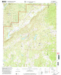
2001 Map of Delta
USGS Topo · Published 2004About this map
Talladega National Forest covers much of the northwest quadrant of this region, which is defined by a landscape of creeks and small crossroads communities. Small rural hubs such as Delta, Needmore, and Haynes Crossroads connect a network of country churches including Good Hope Ch and Bethel Ch. The terrain is marked by significant water features such as Clay County Lake, Lake Gerald, and the waters of Ketchepedrakee Creek flowing through Fishhead Valley. Along Shinbone Ridge and throughout the surrounding hills, several historical cemeteries and congregational sites like Bagan Chapel Cem and Mt Moriah Ch offer clear points of reference for genealogists and local historians tracking the community structure of Clay and Cleburne counties at the start of the 21st century.
Find a feature on this map
33 named features on this map. Tap any name to fly to it.
Don’t see what you’re looking for? This feature index may not catch every label — zoom into the map to look around manually.
Map Details
Editions of this 2001 Delta Map
This is the sole edition of this map. No revisions or reprints were ever made.
Other maps of this area

1891 · Ashland
USGS Topo · 1:125,000

1900 · Anniston
USGS Topo · 1:125,000

1947 · Oxford
USGS Topo · 1:24,000

1950 · Anniston
USGS Topo · 1:62,500

1953 · Atlanta
USGS Topo · 1:250,000

1956 · Oxford
USGS Topo · 1:24,000

1957 · Atlanta
USGS Topo · 1:250,000

1958 · Atlanta
USGS Topo · 1:250,000
1967 · Ross Mountain
USGS Topo · 1:24,000
1967 · Hollis Crossroads
USGS Topo · 1:24,000