
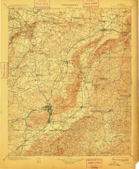
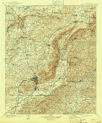
1900 Map of Anniston
USGS Topo · Published 1900About this map
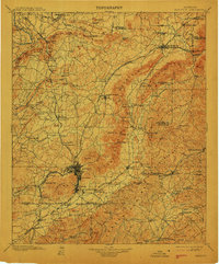
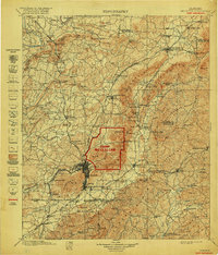
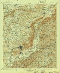
The industrial and railroad landscape of Northeast Alabama is captured in this survey, showcasing the region during its late 19th-century expansion. Anniston serves as the central hub, surrounded by a complex network of rail lines including the Southern Railroad and the Louisville and Nashville Railroad. The map illustrates the convergence of transport and topography, where gaps in the Dry Creek Mountain and Brooks Mountain ranges dictated the paths of these vital iron arteries. To the north, Piedmont and Jacksonville appear as established centers, while the Coosa River defines the western boundary with landmarks like Horton Bend.
Find a feature on this map
149 named features on this map. Tap any name to fly to it.
Don’t see what you’re looking for? This feature index may not catch every label — zoom into the map to look around manually.
Map Details
Editions of this 1900 Anniston Map
6 editions found
Other maps of this area

1885 · Gadsden
USGS Topo · 1:125,000

1886 · Rome
USGS Topo · 1:125,000

1888 · Gadsden
USGS Topo · 1:125,000

1889 · Tallapoosa
USGS Topo · 1:125,000

1889 · Springville
USGS Topo · 1:125,000

1890 · Talladega
USGS Topo · 1:125,000
1891 · Ashland
USGS Topo · 1:125,000

1892 · Springville
USGS Topo · 1:125,000

1892 · Talladega
USGS Topo · 1:125,000

1892 · Tallapoosa
USGS Topo · 1:125,000