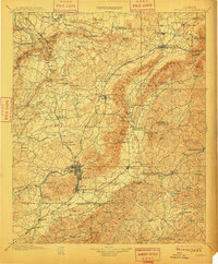
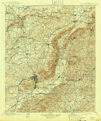
1900 Map of Anniston
USGS Topo · Published 1910About this map
Anniston serves as the industrial and transportation anchor for this late nineteenth-century survey, situated at the confluence of several major rail lines including the Southern Railway and the Louisville and Nashville Railroad. The landscape is defined by the steep ridges of the Choccolocco Mountains and Beasley Mountain, which separate valley settlements like Jacksonville and Alexandria from the timber and mineral lands to the east.
Find a feature on this map
119 named features on this map. Tap any name to fly to it.
Don’t see what you’re looking for? This feature index may not catch every label — zoom into the map to look around manually.
Map Details
Editions of this 1900 Anniston Map
6 editions found

Other maps of this area

1885 · Gadsden
USGS Topo · 1:125,000

1886 · Rome
USGS Topo · 1:125,000

1888 · Gadsden
USGS Topo · 1:125,000

1889 · Tallapoosa
USGS Topo · 1:125,000

1889 · Springville
USGS Topo · 1:125,000

1890 · Talladega
USGS Topo · 1:125,000

1891 · Ashland
USGS Topo · 1:125,000

1892 · Springville
USGS Topo · 1:125,000

1892 · Talladega
USGS Topo · 1:125,000

1892 · Tallapoosa
USGS Topo · 1:125,000