
1956 Map of Oxford
USGS Topo · Published 1960About this map
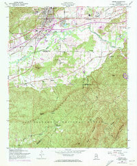
Chocolocco Creek winds through the heart of this landscape, separating the urban development of Oxford and Hobson City from the densely forested ridges of the Talladega National Forest. In the north, the industrial and civic expansion of the mid-1950s is evident in the presence of the Anniston Municipal Airport, the Southern railroad lines, and the County Training Sch. The map reveals a community deeply rooted in its religious and educational institutions, with numerous rural congregations like Pure Holiness Ch, Sweet Rock Ch, and Antioch Ch dotting the valley floor. To the south, the terrain rises sharply toward Kentucky Mountain, where the Lookout Tower Kentucky Ranger Sta stands as a sentinel over the timberlands, reached only by a network of specialized routes like the Motorway.
Find a feature on this map
50 named features on this map. Tap any name to fly to it.
Don’t see what you’re looking for? This feature index may not catch every label — zoom into the map to look around manually.
Map Details
Editions of this 1956 Oxford Map
3 editions found
Other maps of this area

1891 · Ashland
USGS Topo · 1:125,000

1900 · Anniston
USGS Topo · 1:125,000

1947 · Oxford
USGS Topo · 1:24,000

1947 · Anniston
USGS Topo · 1:24,000

1947 · Eulaton
USGS Topo · 1:24,000

1947 · Munford
USGS Topo · 1:24,000

1950 · Anniston
USGS Topo · 1:62,500

1953 · Atlanta
USGS Topo · 1:250,000

1954 · Choccolocco
USGS Topo · 1:24,000

1956 · Munford
USGS Topo · 1:24,000