
1956 Map of Munford
USGS Topo · Published 1960About this map
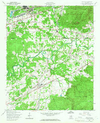
The Anniston Ordnance Depot and the settlement of Bynum dominate the northwestern landscape of this mid-century survey, illustrating the significant military and industrial presence in the region during the 1950s. The terrain transitions from the developed grounds of the depot toward the ridges of Coldwater Mountain and the southern reaches of the Talladega National Forest. Central to the geography is the winding path of Choccolocco Creek, which provides a natural corridor for the Southern and Louisville and Nashville railroads. Local life is documented through numerous rural landmarks such as Antioch Cem, Sweet Home Sch, and the State Fish Hatchery. The map captures the community of Munford at a time when local schools and churches like Halls Grove Ch served as the primary social anchors for the surrounding countryside.
Find a feature on this map
39 named features on this map. Tap any name to fly to it.
Don’t see what you’re looking for? This feature index may not catch every label — zoom into the map to look around manually.
Map Details
Editions of this 1956 Munford Map
4 editions found
Other maps of this area

1889 · Springville
USGS Topo · 1:125,000

1890 · Talladega
USGS Topo · 1:125,000

1891 · Ashland
USGS Topo · 1:125,000

1892 · Springville
USGS Topo · 1:125,000

1892 · Talladega
USGS Topo · 1:125,000

1900 · Anniston
USGS Topo · 1:125,000

1943 · Talladega
USGS Topo · 1:62,500

1946 · Talladega
USGS Topo · 1:62,500

1947 · Oxford
USGS Topo · 1:24,000

1947 · Anniston
USGS Topo · 1:24,000