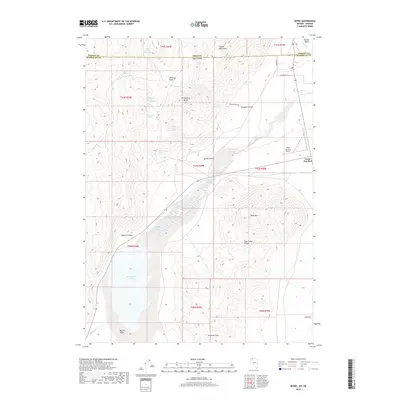
2018 Map of Denio
USGS Topo · Published 2018About this map
The high desert of the Great Basin meets the Oregon border at Denio Junction, a remote crossroads where the Pueblo Mountains and the Pine Forest Range converge. This 2018 survey documents a landscape defined by scarce water resources and wide-open basins, including Bog Hot Valley and the seasonal expanse of Continental Lake. Geothermal activity is evident at Baltazor Hot Spring, while numerous named seeps such as Mustang Spring and State Line Spring reveal the vital hydrology supporting this arid region. The map also traces the historical movement of people through Emigrant Pass and the development of local infrastructure like the Denio Junction Airport. From the cattle-ranching legacy in Alberson Basin to the steep terrain of Black Mtn, the sheet provides a precise record of this tri-county borderland where Nevada and Oregon meet.
Find a feature on this map
40 named features on this map. Tap any name to fly to it.
Don’t see what you’re looking for? This feature index may not catch every label — zoom into the map to look around manually.
Map Details
Editions of this 2018 Denio Map
This is the sole edition of this map. No revisions or reprints were ever made.
Other maps of this area

1886 · Disaster
USGS Topo · 1:250,000

1893 · Disaster
USGS Topo · 1:250,000

1954 · Vya
USGS Topo · 1:250,000

1955 · Adel
USGS Topo · 1:250,000

1957 · Adel
USGS Topo · 1:250,000

1958 · Vya
USGS Topo · 1:250,000

1958 · Adel
USGS Topo · 1:250,000

1962 · Vya
USGS Topo · 1:250,000

1962 · Adel
USGS Topo · 1:250,000

1965 · Railroad Point
USGS Topo · 1:62,500