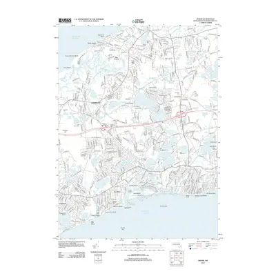
2012 Map of Dennis
USGS Topo · Published 2012About this map
The Bass River serves as the central artery for this coastal landscape, separating Yarmouth from the dense settlements of North Dennis and New Boston. The region's nautical and spiritual heritage is evident in the numerous burial grounds, including the Ancient Cem, Sears Cem, and Paddock Cem, alongside landmarks such as the Bass River West Jetty Light. Higher elevations like Scargo Hill, featuring its Hill Observation Tower, and Black Ball Hill provide vantage points over a complex network of glacial ponds such as Follins Pond, Flax Pond, and Mill Pond. The shoreline is defined by numerous stretches like Mayflower Beach, Chapin Memorial Beach, and Grays Beach, which illustrate the area's long-standing reliance on its marine geography.
Find a feature on this map
95 named features on this map. Tap any name to fly to it.
Don’t see what you’re looking for? This feature index may not catch every label — zoom into the map to look around manually.
Map Details
Editions of this 2012 Dennis Map
This is the sole edition of this map. No revisions or reprints were ever made.
Other maps of this area

1887 · Wellfleet
USGS Topo · 1:62,500

1887 · Yarmouth
USGS Topo · 1:62,500

1888 · Barnstable
USGS Topo · 1:62,500

1889 · Yarmouth
USGS Topo · 1:62,500

1889 · Wellfleet
USGS Topo · 1:62,500

1893 · Yarmouth
USGS Topo · 1:62,500

1893 · Wellfleet
USGS Topo · 1:62,500

1893 · Barnstable
USGS Topo · 1:62,500

1942 · Cape Cod Bay
USGS Topo · 1:125,000
1942 · Hyannis
USGS Topo · 1:31,680