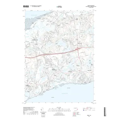
2018 Map of Dennis
USGS Topo · Published 2018About this map
Bass River serves as the central artery for this mid-Cape landscape, dividing the settlements of South Yarmouth and West Dennis as it flows toward the Atlantic Ocean. The geography is characterized by its glacial history, evidenced by numerous kettle ponds such as Miller Pond, Seine Pond, and Perch Pond, alongside elevated points like Scargo Hill and Hokum Rock. Genealogists will find a wealth of burial grounds including the Ancient Sears Cem and Red Top Cem, while the inclusion of the Bridgewater State Univ Cape Cod Campus highlights the area's modern educational infrastructure. The map details the intricate network of shoreline features like Kill Pond Bar and the marshlands surrounding Chase Garden Creek, reflecting the environmental character of the peninsula's southern and northern coasts.
Find a feature on this map
116 named features on this map. Tap any name to fly to it.
Don’t see what you’re looking for? This feature index may not catch every label — zoom into the map to look around manually.
Map Details
Editions of this 2018 Dennis Map
This is the sole edition of this map. No revisions or reprints were ever made.
Other maps of this area

1887 · Wellfleet
USGS Topo · 1:62,500

1887 · Yarmouth
USGS Topo · 1:62,500

1888 · Barnstable
USGS Topo · 1:62,500

1889 · Yarmouth
USGS Topo · 1:62,500

1889 · Wellfleet
USGS Topo · 1:62,500

1893 · Yarmouth
USGS Topo · 1:62,500

1893 · Wellfleet
USGS Topo · 1:62,500

1893 · Barnstable
USGS Topo · 1:62,500

1942 · Cape Cod Bay
USGS Topo · 1:125,000
1942 · Hyannis
USGS Topo · 1:31,680