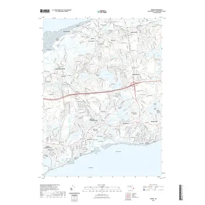
2021 Map of Dennis
USGS Topo · Published 2021About this map
Bass River splits the landscape of the mid-Cape, serving as a natural boundary between the historic villages of Yarmouth and Dennis. This modern survey documents the densely settled coastal corridor from Yarmouth Port down to Dennis Port, where residential neighborhoods and tourism infrastructure sit alongside preserved historical sites. Inland, the map reveals a high concentration of burial grounds, including the Nobscusset Indian Burial Ground and several designated as Ancient Cem, reflecting the deep colonial and indigenous roots of the area.
Find a feature on this map
115 named features on this map. Tap any name to fly to it.
Don’t see what you’re looking for? This feature index may not catch every label — zoom into the map to look around manually.
Map Details
Editions of this 2021 Dennis Map
This is the sole edition of this map. No revisions or reprints were ever made.
Other maps of this area

1887 · Wellfleet
USGS Topo · 1:62,500

1887 · Yarmouth
USGS Topo · 1:62,500

1888 · Barnstable
USGS Topo · 1:62,500

1889 · Yarmouth
USGS Topo · 1:62,500

1889 · Wellfleet
USGS Topo · 1:62,500

1893 · Yarmouth
USGS Topo · 1:62,500

1893 · Wellfleet
USGS Topo · 1:62,500

1893 · Barnstable
USGS Topo · 1:62,500

1942 · Cape Cod Bay
USGS Topo · 1:125,000
1942 · Hyannis
USGS Topo · 1:31,680