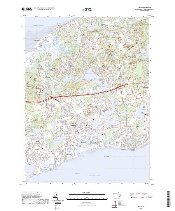
2024 Map of Dennis
USGS Topo · Published 2024About this map
Scargo Hill and Black Ball Hill rise above the dense network of coastal villages and kettle ponds that define this portion of Cape Cod. Stretching from North Dennis on the Atlantic Ocean south to Dennis Port and West Dennis, the landscape is a complex weave of historical memory and modern infrastructure. Genealogy interests are well-served by numerous burial sites, including the Ancient Cem, the Indian Burial Ground, and the Ancient Sears Cem. The geography of the mid-Cape is evident in the sprawling Bass Hole Marshes and the passage of the Bass River, which separates South Yarmouth from the Dennis townships. Transport patterns are visible through the Cape Cod Rail Trail, which follows the old railroad corridor across the map, while institutional landmarks like the Bridgewater State University Cape Cod Campus highlight the area's contemporary role.
Find a feature on this map
128 named features on this map. Tap any name to fly to it.
Don’t see what you’re looking for? This feature index may not catch every label — zoom into the map to look around manually.
Map Details
Editions of this 2024 Dennis Map
This is the sole edition of this map. No revisions or reprints were ever made.
Other maps of this area

1887 · Wellfleet
USGS Topo · 1:62,500

1887 · Yarmouth
USGS Topo · 1:62,500

1888 · Barnstable
USGS Topo · 1:62,500

1889 · Yarmouth
USGS Topo · 1:62,500

1889 · Wellfleet
USGS Topo · 1:62,500

1893 · Yarmouth
USGS Topo · 1:62,500

1893 · Wellfleet
USGS Topo · 1:62,500

1893 · Barnstable
USGS Topo · 1:62,500

1942 · Cape Cod Bay
USGS Topo · 1:125,000
1942 · Hyannis
USGS Topo · 1:31,680