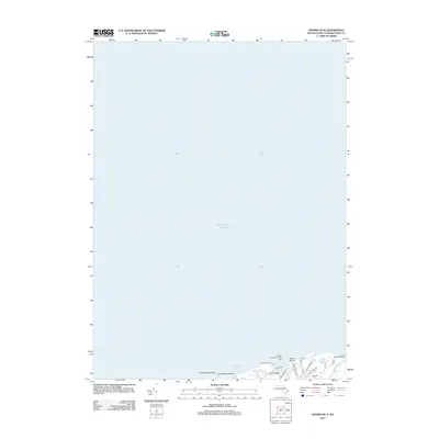
2012 Map of Dennis OE N
USGS Topo · Published 2012About this map
Sesuit Harbor and its surrounding coastal necks dominate this 2012 survey, where the maritime heritage of the Massachusetts shore meets modern recreational geography. The presence of the Shiverick Shipyard indicates a lineage of local industry near the water, while the Sesuit Harbor West Jetty Light marks the entrance to a vital harbor for Cape Cod sailors. The landscape is characterized by prominent points such as Nobscusset Point and protected tidal areas like Nobscusset Harbor. Inland, residential development is organized around a grid of local ways including Sesuit Rd and Cold Storage Rd, while the Quivett Cem provides a point of genealogical interest for those tracing family roots in the area. Between Corporation Beach and Sesuit Beach, the map details a shoreline defined by both its natural contours and its established navigation aids.
Find a feature on this map
22 named features on this map. Tap any name to fly to it.
Don’t see what you’re looking for? This feature index may not catch every label — zoom into the map to look around manually.
Map Details
Editions of this 2012 Dennis OE N Map
This is the sole edition of this map. No revisions or reprints were ever made.
Other maps of this area

1887 · Wellfleet
USGS Topo · 1:62,500

1887 · Yarmouth
USGS Topo · 1:62,500

1888 · Barnstable
USGS Topo · 1:62,500

1889 · Yarmouth
USGS Topo · 1:62,500

1889 · Wellfleet
USGS Topo · 1:62,500

1893 · Yarmouth
USGS Topo · 1:62,500

1893 · Wellfleet
USGS Topo · 1:62,500

1893 · Barnstable
USGS Topo · 1:62,500

1942 · Cape Cod Bay
USGS Topo · 1:125,000
1943 · Dennis
USGS Topo · 1:31,680