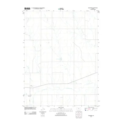
2012 Map of Densmore
USGS Topo · Published 2012About this map
Densmore occupies the southwestern corner of this West Central Kansas landscape, situated near the winding course of the N Fork Solomon River. The area is characterized by a dendritic drainage pattern where numerous creeks, including Scull Cr, Cactus Cr, and Big Timber Cr, carve through the plains to feed the larger river system. Just west of the main settlement, Mount Calvary Cem serves as a significant local landmark for genealogical research.
Find a feature on this map
10 named features on this map. Tap any name to fly to it.
Don’t see what you’re looking for? This feature index may not catch every label — zoom into the map to look around manually.
Map Details
Editions of this 2012 Densmore Map
This is the sole edition of this map. No revisions or reprints were ever made.
Other maps of this area

1893 · Norton
USGS Topo · 1:125,000

1951 · Norton
USGS Topo · 1:62,500

1955 · Beloit
USGS Topo · 1:250,000

1959 · Beloit
USGS Topo · 1:250,000

1978 · Logan
USGS Topo · 1:24,000
1978 · Calvert
USGS Topo · 1:24,000

1978 · Edmond
USGS Topo · 1:24,000
1978 · Densmore
USGS Topo · 1:24,000

1978 · Edmond SE
USGS Topo · 1:24,000
1978 · Prairie View
USGS Topo · 1:24,000