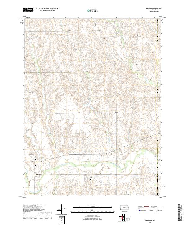
2022 Map of Densmore
USGS Topo · Published 2022About this map
Densmore occupies a position along the southern reaches of this landscape, situated near the winding course of the N Fork Solomon River. This portion of Norton County is characterized by a high density of intermittent drainage systems, such as Scull Cr and Cactus Cr, which carve through the plains to meet the river valley. For genealogists and local historians, several burial sites are documented within a small radius of the settlement, including Mount Calvary Cem, Densmore Cem, and the more isolated West Union Cem to the east. The terrain is marked by a rigorous section-line road grid, with Big Dutchman Lake providing a notable exception to the predominantly agricultural and prairie land use found throughout the northern sections of the survey.
Find a feature on this map
36 named features on this map. Tap any name to fly to it.
Don’t see what you’re looking for? This feature index may not catch every label — zoom into the map to look around manually.
Map Details
Editions of this 2022 Densmore Map
This is the sole edition of this map. No revisions or reprints were ever made.
Other maps of this area

1893 · Norton
USGS Topo · 1:125,000

1951 · Norton
USGS Topo · 1:62,500

1955 · Beloit
USGS Topo · 1:250,000

1959 · Beloit
USGS Topo · 1:250,000

1978 · Logan
USGS Topo · 1:24,000
1978 · Calvert
USGS Topo · 1:24,000

1978 · Edmond
USGS Topo · 1:24,000
1978 · Densmore
USGS Topo · 1:24,000

1978 · Edmond SE
USGS Topo · 1:24,000
1978 · Prairie View
USGS Topo · 1:24,000