Loading...
Loading map...2022 Map of Dent
USGS Topo · Published 2022About this map
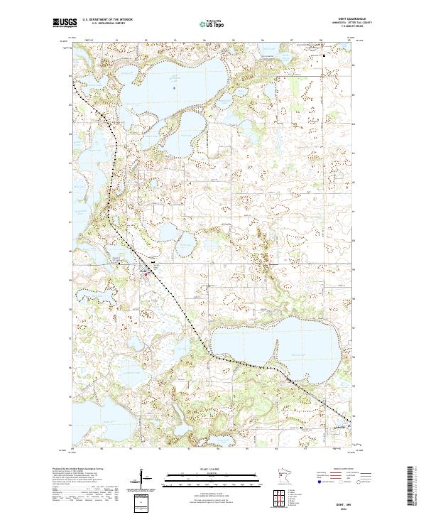
Dent and Richville anchor this portion of Otter Tail County, a landscape defined by an intricate network of glacial lakes. The settlement of Dent serves as a central point, surrounded by local heritage sites including Immanuel Cem, Pleasant Hill Cem, and Sacred Heart Cem. To the southeast, the village of Richville sits near the shores of Marion Lake and its own Richville Cem.
Find a feature on this map
97 named features on this map. Tap any name to fly to it.
Don’t see what you’re looking for? This feature index may not catch every label — zoom into the map to look around manually.
Map Details
Date Portrayed2022
Date Published2022
PublisherU.S. Geological Survey
Map TypeTopographic
Scale1:24000
Physical Dimensions24 x 29 inches
Editions of this 2022 Dent Map
This is the sole edition of this map. No revisions or reprints were ever made.
Historical Maps of Dent Through Time
Featured Locations
Source Details
SourceU.S. Geological Survey
CopyrightPublic Domain