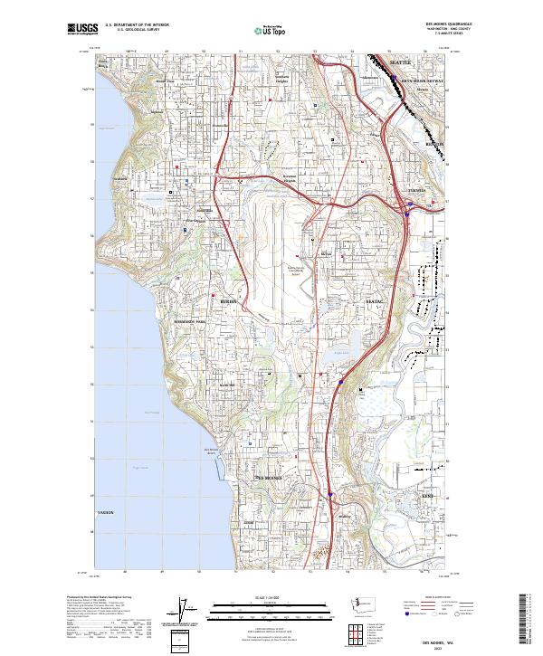
2023 Map of Des Moines
USGS Topo · Published 2023About this map
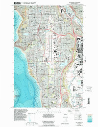
The dense suburban landscape of King County is anchored by the Seattle-Tacoma International Airport, which dominates the central geography between Burien and SeaTac. This corridor along the East Passage reveals a high concentration of established neighborhoods and community landmarks, from the coastal reaches of Seola Beach and Des Moines Beach to the residential grids of Riverton Heights and Sunnydale. Water remains a defining element of the local topography, with numerous small lakes such as Angle Lake, Bow Lake, and Burien Lake punctuating the developed upland areas east of the shoreline.
Find a feature on this map
202 named features on this map. Tap any name to fly to it.
Don’t see what you’re looking for? This feature index may not catch every label — zoom into the map to look around manually.
Map Details
Editions of this 2023 Des Moines Map
This is the sole edition of this map. No revisions or reprints were ever made.