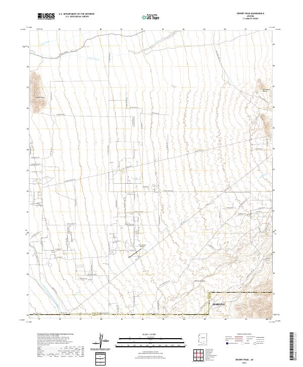
2021 Map of Desert Peak
USGS Topo · Published 2021About this map
Desert Peak and the Owl Head Buttes anchor this portion of the Sonoran landscape where Pinal and Pima counties meet. The northern edge of Marana is visible at the southern boundary, showing a pattern of modern expansion and residential development near the Central Arizona Project Aqueduct. This infrastructure, which cuts across the southwest, represents a vital artery for regional water management in an arid environment defined by seasonal drainages like Barker Wash, Suizo Wash, and Guild Wash.
Find a feature on this map
64 named features on this map. Tap any name to fly to it.
Don’t see what you’re looking for? This feature index may not catch every label — zoom into the map to look around manually.
Map Details
Editions of this 2021 Desert Peak Map
This is the sole edition of this map. No revisions or reprints were ever made.
Other maps of this area

1934 · Tucson Mountains
USGS Topo · 1:125,000

1934 · Newman Peak
USGS Topo · 1:125,000

1947 · Cortaro
USGS Topo · 1:62,500

1947 · Red Rock
USGS Topo · 1:62,500

1956 · Tucson
USGS Topo · 1:250,000

1957 · Cortaro
USGS Topo · 1:62,500

1958 · Tucson
USGS Topo · 1:250,000

1959 · Tucson
USGS Topo · 1:250,000

1959 · Tortolita Mts
USGS Topo · 1:62,500
1959 · Silver Bell Peak
USGS Topo · 1:62,500