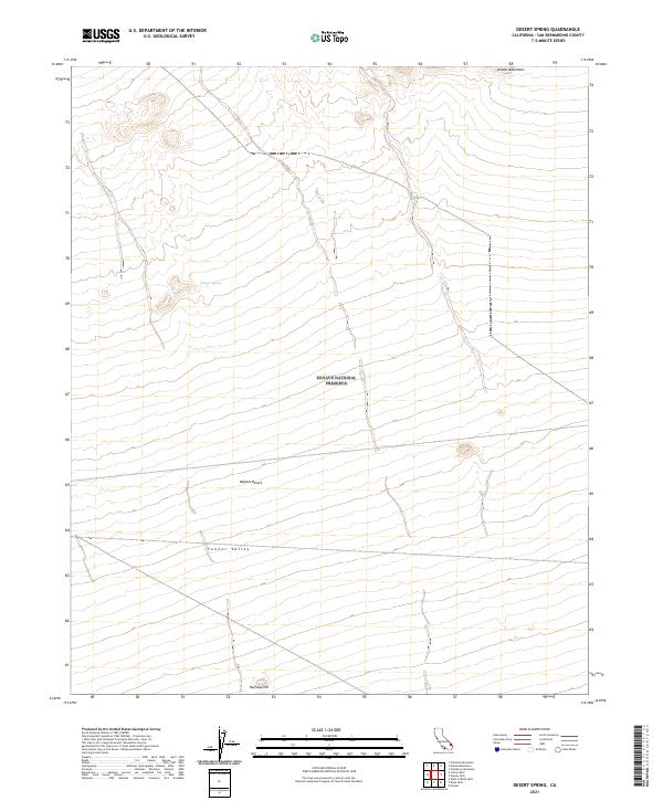
2021 Map of Desert Spring
USGS Topo · Published 2021About this map
Mojave National Preserve encompasses most of this landscape, protecting a stark desert environment where rare water sources like Desert Spring become critical landmarks for both wildlife and travelers. This high-desert terrain is defined by dramatic elevation shifts, from the prominent Woods Mountains in the northeast to the broad expanse of the Fenner Valley that slopes toward the south. The 2021 survey illustrates how modern conservation boundaries overlay traditional geological features like Halfway Hill, reflecting a managed wilderness era in the Mojave Desert. Sparse roads and 4WD tracks trace the contours of the land, connecting isolated points of interest across the township and range grid, serving as a contemporary record of this protected California corridor.
Find a feature on this map
11 named features on this map. Tap any name to fly to it.
Don’t see what you’re looking for? This feature index may not catch every label — zoom into the map to look around manually.
Map Details
Editions of this 2021 Desert Spring Map
This is the sole edition of this map. No revisions or reprints were ever made.
Other maps of this area

1910 · Ivanpah
USGS Topo · 1:250,000

1912 · Ivanpah
USGS Topo · 1:250,000

1942 · Ivanpah
USGS Topo · 1:250,000

1942 · Amboy
USGS Topo · 1:250,000

1943 · Amboy
USGS Topo · 1:250,000

1943 · Fenner
USGS Topo · 1:62,500

1947 · Kingman
USGS Topo · 1:250,000

1948 · Kingman
USGS Topo · 1:250,000

1954 · Needles
USGS Topo · 1:250,000

1954 · Kingman
USGS Topo · 1:250,000