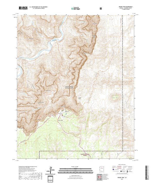
2021 Map of Desert View
USGS Topo · Published 2021About this map
Desert View serves as a primary access point to the South Rim's eastern reaches within Grand Canyon National Park. This 2021 survey illustrates a landscape defined by sharp elevation changes, where high overlooks like Navajo Point and Lipan Point gaze down upon the winding Colorado River. The complex topography of the inner canyon is revealed through names like Basalt Canyon and Tanner Canyon, while the high desert plateaus transition into the Kaibab National Forest to the south.
Find a feature on this map
43 named features on this map. Tap any name to fly to it.
Don’t see what you’re looking for? This feature index may not catch every label — zoom into the map to look around manually.
Map Details
Editions of this 2021 Desert View Map
This is the sole edition of this map. No revisions or reprints were ever made.
Other maps of this area

1886 · San Francisco Mtns
USGS Topo · 1:250,000

1886 · Echo Cliffs
USGS Topo · 1:250,000

1891 · San Francisco Mtns
USGS Topo · 1:250,000

1891 · Echo Cliffs
USGS Topo · 1:250,000

1894 · San Francisco Mtns
USGS Topo · 1:250,000

1899 · San Francisco Mtns
USGS Topo · 1:250,000

1907 · Vishnu
USGS Topo · 1:48,000

1947 · Flagstaff
USGS Topo · 1:250,000

1954 · Flagstaff
USGS Topo · 1:250,000

1955 · Blue Spring
USGS Topo · 1:62,500