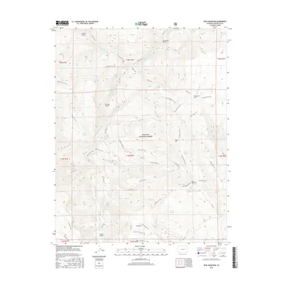
2016 Map of Devil Mountain
USGS Topo · Published 2016About this map
San Juan National Forest encompasses this high-elevation landscape in Archuleta County, where the Piedra River and its many tributaries carve deep through the terrain. The presence of the Piedra River Hot Springs along the river's western bank suggests a geothermal character to this wilderness area. The map documents an intricate network of waterways including Devil Cr, Dudley Cr, and the appropriately named Lower Horse Crk. Significant relief is defined by Devil Mountain and Horse Mtn, while the deep cuts of First Box Canyon and Second Box Canyon illustrate the powerful erosive force of the regional watershed. A dense web of forest access routes, such as the Beaver Lakes Trail and the Mule Mountain Trail, provides the primary means of navigating these peaks and canyons.
Find a feature on this map
52 named features on this map. Tap any name to fly to it.
Don’t see what you’re looking for? This feature index may not catch every label — zoom into the map to look around manually.
Map Details
Editions of this 2016 Devil Mountain Map
This is the sole edition of this map. No revisions or reprints were ever made.
Other maps of this area

1924 · Pagosa Springs
USGS Topo · 1:125,000

1927 · Pagosa Springs
USGS Topo · 1:125,000

1945 · Durango
USGS Topo · 1:250,000

1953 · Durango
USGS Topo · 1:250,000

1954 · Durango
USGS Topo · 1:250,000

1957 · Pagosa Junction
USGS Topo · 1:62,500

1961 · Durango
USGS Topo · 1:250,000

1963 · Durango
USGS Topo · 1:250,000
1964 · Chris Mountain
USGS Topo · 1:24,000
1964 · Devil Mountain
USGS Topo · 1:24,000