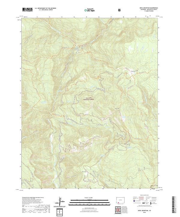
2022 Map of Devil Mountain
USGS Topo · Published 2022About this map
San Juan National Forest defines this high-elevation landscape, where the Piedra River carves through the First Box Canyon. The terrain is marked by a series of prominent peaks, including Baldy Mountain, Horse Mountain, and Devil Mountain, linked by an extensive network of specialized trails. Notable for its geothermal activity, the area features the Piedra River Hot Springs along the western riverbank. The map documents numerous water sources critical for high-country navigation and wildlife, such as Mesa Spring Number 1, Mesa Spring Number 2, and Farrow Spring. A complex system of forest routes, including the Monument Park Atv Trl and various winter-only tracks, suggests a landscape managed for seasonal access and multiple recreational uses within the national forest boundaries.
Find a feature on this map
70 named features on this map. Tap any name to fly to it.
Don’t see what you’re looking for? This feature index may not catch every label — zoom into the map to look around manually.
Map Details
Editions of this 2022 Devil Mountain Map
This is the sole edition of this map. No revisions or reprints were ever made.
Other maps of this area

1924 · Pagosa Springs
USGS Topo · 1:125,000

1927 · Pagosa Springs
USGS Topo · 1:125,000

1945 · Durango
USGS Topo · 1:250,000

1953 · Durango
USGS Topo · 1:250,000

1954 · Durango
USGS Topo · 1:250,000

1957 · Pagosa Junction
USGS Topo · 1:62,500

1961 · Durango
USGS Topo · 1:250,000

1963 · Durango
USGS Topo · 1:250,000
1964 · Chris Mountain
USGS Topo · 1:24,000
1964 · Devil Mountain
USGS Topo · 1:24,000