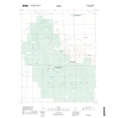
2018 Map of Devils Hole
USGS Topo · Published 2018About this map
Ash Meadows National Wildlife Refuge and a portion of Death Valley National Park define this arid landscape, where rare desert water sources cluster in a transition between the Amargosa Desert and the Mojave Desert. The map centers on the unique geological feature of Devils Hole, a detached unit of Death Valley surrounded by the refuge. This area is characterized by an extraordinary density of named desert springs, including Fairbanks Spring, Rogers Spring, and the clustered Point of Rocks Springs, which sustained the small settlement at Ash Meadows and the Davis Ranch Spring. The intricate hydrography shown here, from the Carson Slough to man-made features like Crystal Reservoir and Horseshoe Reservoir, highlights the critical importance of water management and natural seeps in this part of Nye County. Surveyed routes such as Spring Meadows Rd and the Foot Trl provide a look at how this fragile environment has been accessed and preserved.
Find a feature on this map
54 named features on this map. Tap any name to fly to it.
Don’t see what you’re looking for? This feature index may not catch every label — zoom into the map to look around manually.
Map Details
Editions of this 2018 Devils Hole Map
This is the sole edition of this map. No revisions or reprints were ever made.
Other maps of this area

1908 · Furnace Creek
USGS Topo · 1:250,000

1910 · Furnace Creek
USGS Topo · 1:250,000

1942 · Skull Mountain
USGS Topo · 1:125,000

1948 · Death Valley
USGS Topo · 1:250,000

1952 · Ash Meadows
USGS Topo · 1:62,500

1952 · Specter Range
USGS Topo · 1:62,500

1954 · Death Valley
USGS Topo · 1:250,000

1956 · Death Valley
USGS Topo · 1:250,000

1957 · Death Valley
USGS Topo · 1:250,000

1958 · Death Valley
USGS Topo · 1:250,000