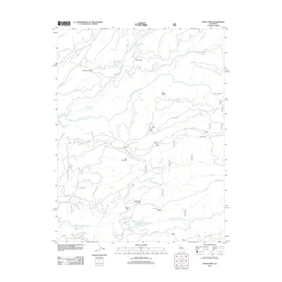
2012 Map of Devils Nose
USGS Topo · Published 2012About this map
North Fork Mokelumne River and the Middle Fork Mokelumne River define this deeply dissected landscape in the Sierra Nevada foothills. The water system is heavily managed for power and storage, evidenced by the Tiger Creek Reservoir, Tiger Creek Forbay, and Tiger Creek Regulation Reservoir in the northwest, alongside Schaads Reservoir to the south. Local transit and settlement patterns are dictated by the terrain, with small clusters like Porter, McClain, and Cooks Ranch positioned near the winding road network. High points and clearings such as Devils Nose, Bald Mountain, and Hunter Flat serve as primary landmarks. The map also traces an intricate series of forest routes, including the Lily Gap Rd and Winton Rd, which connect the scattered homesteads and water resources of this Calaveras County region.
Find a feature on this map
77 named features on this map. Tap any name to fly to it.
Don’t see what you’re looking for? This feature index may not catch every label — zoom into the map to look around manually.
Map Details
Editions of this 2012 Devils Nose Map
This is the sole edition of this map. No revisions or reprints were ever made.
Other maps of this area

1889 · Jackson
USGS Topo · 1:125,000

1889 · Pyramid Peak
USGS Topo · 1:125,000

1891 · Big Trees
USGS Topo · 1:125,000

1891 · Placerville
USGS Topo · 1:125,000

1891 · Pyramid Peak
USGS Topo · 1:125,000

1892 · Jackson
USGS Topo · 1:125,000

1892 · Placerville
USGS Topo · 1:125,000

1893 · Placerville
USGS Topo · 1:125,000

1894 · Big Trees
USGS Topo · 1:125,000

1895 · Pyramid Peak
USGS Topo · 1:125,000