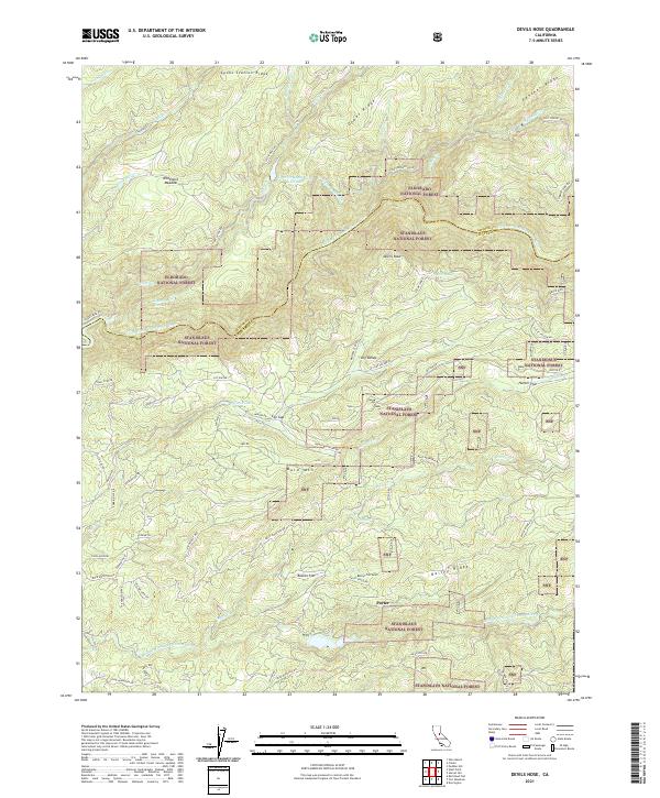
2021 Map of Devils Nose
USGS Topo · Published 2021About this map
The North Fork Mokelumne River and the Middle Fork Mokelumne River carve through the deep drainages of the Sierra Nevada foothills on this 2021 survey. The landscape is defined by the complex water infrastructure of the Tiger Cr Regulation Reservoir, the Tiger Cr Conduit, and the Tiger Cr Forbay, which trace the elevation contours to manage the region's hydroelectric potential.
Find a feature on this map
69 named features on this map. Tap any name to fly to it.
Don’t see what you’re looking for? This feature index may not catch every label — zoom into the map to look around manually.
Map Details
Editions of this 2021 Devils Nose Map
This is the sole edition of this map. No revisions or reprints were ever made.
Other maps of this area

1889 · Jackson
USGS Topo · 1:125,000

1889 · Pyramid Peak
USGS Topo · 1:125,000

1891 · Big Trees
USGS Topo · 1:125,000

1891 · Placerville
USGS Topo · 1:125,000

1891 · Pyramid Peak
USGS Topo · 1:125,000

1892 · Jackson
USGS Topo · 1:125,000

1892 · Placerville
USGS Topo · 1:125,000

1893 · Placerville
USGS Topo · 1:125,000

1894 · Big Trees
USGS Topo · 1:125,000

1895 · Pyramid Peak
USGS Topo · 1:125,000