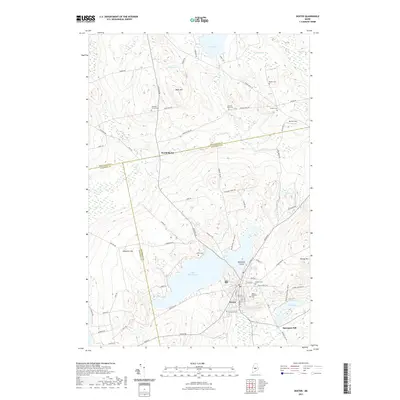
2021 Map of Dexter
USGS Topo · Published 2021About this map
Lake Wassookeag serves as the central geographic feature of this Maine landscape, with the town of Dexter situated at its southeastern tip. The area reflects a classic New England settlement pattern, characterized by numerous small family and community burial grounds scattered across the terrain, such as Jackman Corner Cem and Storer Cem. Local industry and geography are linked at Spooners Mill near Fay Scott Bog, while the northern reaches transitions into a series of wetlands including Lougee Bog and Brown Bog. The township's elevation is defined by prominent rises like Main Street Hill, Bean Hill, and Hersey Hill, which overlook a network of rural roads that connect outlying clusters like North Dexter to the primary village center.
Find a feature on this map
75 named features on this map. Tap any name to fly to it.
Don’t see what you’re looking for? This feature index may not catch every label — zoom into the map to look around manually.
Map Details
Editions of this 2021 Dexter Map
This is the sole edition of this map. No revisions or reprints were ever made.
Other maps of this area

1930 · Pittsfield
USGS Topo · 1:48,000

1931 · Stetson
USGS Topo · 1:48,000

1932 · Dover-Foxcroft
USGS Topo · 1:48,000

1932 · Pittsfield
USGS Topo · 1:62,500

1933 · Pittsfield
USGS Topo · 1:62,500

1933 · Guilford
USGS Topo · 1:62,500

1935 · Dover-Foxcroft
USGS Topo · 1:62,500

1935 · Stetson
USGS Topo · 1:62,500

1937 · Guilford
USGS Topo · 1:62,500

1948 · Bangor
USGS Topo · 1:250,000