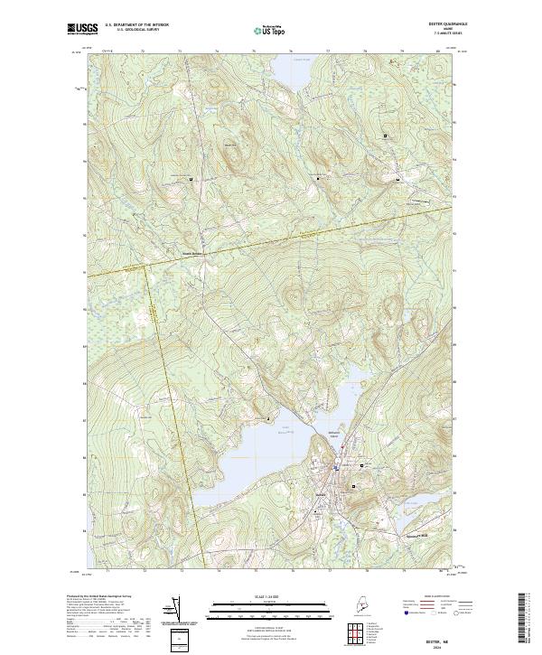
2024 Map of Dexter
USGS Topo · Published 2024About this map
Lake Wassookeag serves as the centerpiece of this central Maine landscape, where the town of Dexter sits at the southern outlet. The area's industrial past is anchored by Spooners Mill along the East Branch Sebasticook River, while the northern portion of the map transitions into a complex network of wetlands including Brown Bog, Lougee Bog, and Grey Bog. This 2024 survey captures a high density of burial sites for a single quadrangle, documenting Mount Pleasant Cem, Greene Cem, Elmwood Cem, and several others that serve as critical markers for local genealogy. Between the elevations of Bean Hill and Hersey Hill, the map traces the intersection of three counties—Piscataquis, Somerset, and Penobscot—illustrating how local roads like Silver Mills Rd and Cambridge Rd connect these outlying rural settlements to the primary hub at North Dexter.
Find a feature on this map
109 named features on this map. Tap any name to fly to it.
Don’t see what you’re looking for? This feature index may not catch every label — zoom into the map to look around manually.
Map Details
Editions of this 2024 Dexter Map
This is the sole edition of this map. No revisions or reprints were ever made.
Other maps of this area

1930 · Pittsfield
USGS Topo · 1:48,000

1931 · Stetson
USGS Topo · 1:48,000

1932 · Dover-Foxcroft
USGS Topo · 1:48,000

1932 · Pittsfield
USGS Topo · 1:62,500

1933 · Pittsfield
USGS Topo · 1:62,500

1933 · Guilford
USGS Topo · 1:62,500

1935 · Dover-Foxcroft
USGS Topo · 1:62,500

1935 · Stetson
USGS Topo · 1:62,500

1937 · Guilford
USGS Topo · 1:62,500

1948 · Bangor
USGS Topo · 1:250,000