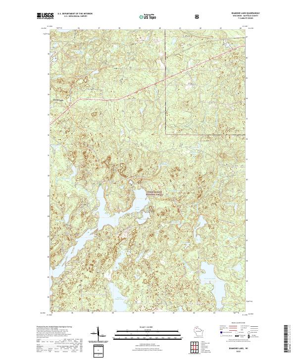
2022 Map of Diamond Lake
USGS Topo · Published 2022About this map
The town of Drummond serves as a gateway to the dense woodlands of the Chequamegon National Forest in this recent survey. This area of northern Wisconsin is defined by a complex network of glacial lakes and springs, including the expansive Lake Owen and its smaller neighbor, Bass Lake. The landscape is a haven for outdoorsmen and conservationists, featuring the winding path of the North Country National Scenic Trl as it traverses the lake-strewn terrain.
Find a feature on this map
39 named features on this map. Tap any name to fly to it.
Don’t see what you’re looking for? This feature index may not catch every label — zoom into the map to look around manually.
Map Details
Editions of this 2022 Diamond Lake Map
This is the sole edition of this map. No revisions or reprints were ever made.
Other maps of this area

1943 · Namekagon Lake
USGS Topo · 1:48,000

1944 · Drummond
USGS Topo · 1:48,000

1944 · Grandview
USGS Topo · 1:48,000

1944 · Hayward
USGS Topo · 1:48,000

1945 · Namekagon Lake
USGS Topo · 1:48,000

1947 · Drummond
USGS Topo · 1:48,000

1947 · Grandview
USGS Topo · 1:48,000

1953 · Ashland
USGS Topo · 1:250,000

1958 · Ashland
USGS Topo · 1:250,000
1971 · Delta
USGS Topo · 1:24,000