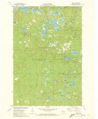
1971 Map of Delta
USGS Topo · Published 1973About this map
Chequamegon National Forest dominates this landscape in northern Wisconsin, where a high concentration of glacial lakes defines the local topography. The area is centered around the Delta Lookout Tower, which provides a strategic vantage over the heavily wooded and lake-studded terrain of Bayfield County. Larger water bodies such as Muskellunge Lake, Eagle Lake, and Lake Delta are situated among smaller, uniquely named features like Canthook Lake and Steelhead Lake.
Find a feature on this map
61 named features on this map. Tap any name to fly to it.
Don’t see what you’re looking for? This feature index may not catch every label — zoom into the map to look around manually.
Map Details
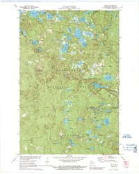
Editions of this 1971 Delta Map
2 editions found
Other maps of this area

1943 · Iron Lake
USGS Topo · 1:48,000

1944 · Moquah
USGS Topo · 1:48,000

1944 · Drummond
USGS Topo · 1:48,000

1944 · Grandview
USGS Topo · 1:48,000

1947 · Drummond
USGS Topo · 1:48,000

1947 · Moquah
USGS Topo · 1:48,000

1947 · Iron Lake
USGS Topo · 1:48,000

1947 · Grandview
USGS Topo · 1:48,000

1953 · Ashland
USGS Topo · 1:250,000

1958 · Ashland
USGS Topo · 1:250,000