
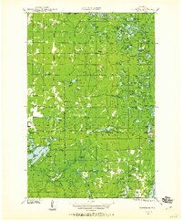
1944 Map of Moquah
USGS Topo · Published 1952About this map
The Chequamegon National Forest landscape near Moquah is defined by its mid-century timber management and small railway settlements. This 1944 field examination reveals a network of former logging routes, marked here as Old Grade, winding through townships like Washburn and Barksdale. These grades suggest the transition from early industrial extraction to managed conservation, anchored by the Brinks Ranger Sta and the Moquah Fire Tower.
Find a feature on this map
54 named features on this map. Tap any name to fly to it.
Don’t see what you’re looking for? This feature index may not catch every label — zoom into the map to look around manually.
Map Details
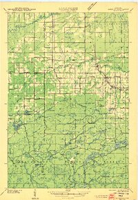
Editions of this 1944 Moquah Map
2 editions found

Other maps of this area

1941 · Bayfield
USGS Topo · 1:48,000

1942 · Ashland
USGS Topo · 1:48,000

1942 · Marengo
USGS Topo · 1:48,000

1943 · Port Wing
USGS Topo · 1:48,000

1943 · Iron Lake
USGS Topo · 1:48,000

1944 · Cornucopia
USGS Topo · 1:48,000
1944 · Drummond
USGS Topo · 1:48,000

1944 · Grandview
USGS Topo · 1:48,000
1945 · Marengo
USGS Topo · 1:48,000

1946 · Cornucopia
USGS Topo · 1:48,000