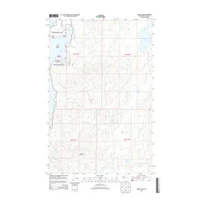
2014 Map of Dickey Lake
USGS Topo · Published 2014About this map
Olympic National Park defines the western edge of this coastal wilderness, where the rugged shoreline of Ozette Lake meets the dense forest of the Olympic Peninsula. The terrain is a complex network of drainage systems, including the headwaters and branches of the W Fork Dickey River and E Fork Dickey River, which cut through the lower elevations of the Olympic Mountains. Historical shoreline landmarks like Preachers Point, Bensons Point, and Rocky Point mark the eastern reaches of the lake, while Garden Island sits as a lonely outlier in the water. Moving eastward, the map reveals a remote landscape of smaller water bodies such as Dickey Lake, Big Joes Lake, and Wentworth Lake. The presence of the Ozette Mnln and Swan Bay Rd provides the primary access through this heavily timbered country, reflecting the isolation of this corner of Clallam County.
Find a feature on this map
34 named features on this map. Tap any name to fly to it.
Don’t see what you’re looking for? This feature index may not catch every label — zoom into the map to look around manually.
Map Details
Editions of this 2014 Dickey Lake Map
This is the sole edition of this map. No revisions or reprints were ever made.
Other maps of this area

1935 · Ozette Lake
USGS Topo · 1:62,500

1935 · Lake Pleasant
USGS Topo · 1:62,500

1939 · Forks
USGS Topo · 1:62,500

1942 · Ozette Lake
USGS Topo · 1:62,500

1942 · Lake Pleasant
USGS Topo · 1:62,500

1943 · Copalis Beach
USGS Topo · 1:250,000

1951 · Copalis Beach
USGS Topo · 1:250,000

1953 · Cape Flattery
USGS Topo · 1:250,000

1956 · La Push
USGS Topo · 1:62,500

1956 · Ozette Lake
USGS Topo · 1:62,500