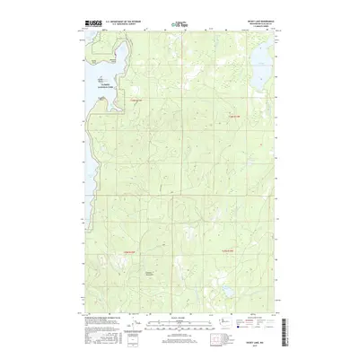
2017 Map of Dickey Lake
USGS Topo · Published 2017About this map
Olympic National Park encompasses the western portion of this coastal landscape, where the waters of Ozette Lake meet the forest at points like Rocky Point and Preachers Point. The map details a complex network of freshwater systems, including Swan Bay, Boot Bay, and the smaller Wentworth Lake. Inland, the terrain is defined by the drainage basins of the West Fork Dickey River and Crooked Cr, which wind through the foothills of the Olympic Mountains. Navigational access into this wilderness is shown via Swan Bay Rd and the Ozette Mnln, tracing the historical transition from the lake shore toward the more secluded Dickey Lake in the northeast. The presence of Garden Island within the lake and the diverse creek names like Siwash Cr and Squaw Cr reflect a landscape heavily influenced by its glacial hydrology and indigenous geography.
Find a feature on this map
34 named features on this map. Tap any name to fly to it.
Don’t see what you’re looking for? This feature index may not catch every label — zoom into the map to look around manually.
Map Details
Editions of this 2017 Dickey Lake Map
This is the sole edition of this map. No revisions or reprints were ever made.
Other maps of this area

1935 · Ozette Lake
USGS Topo · 1:62,500

1935 · Lake Pleasant
USGS Topo · 1:62,500

1939 · Forks
USGS Topo · 1:62,500

1942 · Ozette Lake
USGS Topo · 1:62,500

1942 · Lake Pleasant
USGS Topo · 1:62,500

1943 · Copalis Beach
USGS Topo · 1:250,000

1951 · Copalis Beach
USGS Topo · 1:250,000

1953 · Cape Flattery
USGS Topo · 1:250,000

1956 · La Push
USGS Topo · 1:62,500

1956 · Ozette Lake
USGS Topo · 1:62,500