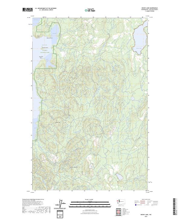
2023 Map of Dickey Lake
USGS Topo · Published 2023About this map
The Olympic National Park boundary defines the western portion of this coastal Washington landscape, where the dense rainforest meets the shores of Ozette Lake. On the lake's eastern edge, the terrain transitions into the foothills of the Olympic Mountains, marked by landmarks like Birkestol Hill and carved by an intricate network of waterways including Crooked Creek and Siwash Creek. This modern survey illustrates the persistent isolation of the Olympic Peninsula's interior, showing a landscape dominated by water and topography rather than human settlement.
Find a feature on this map
30 named features on this map. Tap any name to fly to it.
Don’t see what you’re looking for? This feature index may not catch every label — zoom into the map to look around manually.
Map Details
Editions of this 2023 Dickey Lake Map
This is the sole edition of this map. No revisions or reprints were ever made.
Other maps of this area

1935 · Ozette Lake
USGS Topo · 1:62,500

1935 · Lake Pleasant
USGS Topo · 1:62,500

1939 · Forks
USGS Topo · 1:62,500

1942 · Ozette Lake
USGS Topo · 1:62,500

1942 · Lake Pleasant
USGS Topo · 1:62,500

1943 · Copalis Beach
USGS Topo · 1:250,000

1951 · Copalis Beach
USGS Topo · 1:250,000

1953 · Cape Flattery
USGS Topo · 1:250,000

1956 · La Push
USGS Topo · 1:62,500

1956 · Ozette Lake
USGS Topo · 1:62,500