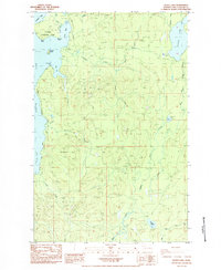
1984 Map of Dickey Lake
USGS Topo · Published 1984About this map
Olympic National Park defines the western edge of this coastal landscape, where the eastern shoreline of Ozette Lake meets the dense timberlands of Clallam County. This 1984 provisional survey illustrates a complex network of industrial forest use, marked by numerous borrow pits, gravel pits, and quarries scattered across the ridges. Evidence of earlier logging infrastructure is visible in the prominent Old RR Grade that winds through the northern sections, tracing a legacy of timber transport before modern road systems took over.
Find a feature on this map
31 named features on this map. Tap any name to fly to it.
Don’t see what you’re looking for? This feature index may not catch every label — zoom into the map to look around manually.
Map Details
Editions of this 1984 Dickey Lake Map
This is the sole edition of this map. No revisions or reprints were ever made.
Other maps of this area

1935 · Ozette Lake
USGS Topo · 1:62,500

1935 · Lake Pleasant
USGS Topo · 1:62,500

1939 · Forks
USGS Topo · 1:62,500

1942 · Ozette Lake
USGS Topo · 1:62,500

1942 · Lake Pleasant
USGS Topo · 1:62,500

1943 · Copalis Beach
USGS Topo · 1:250,000

1951 · Copalis Beach
USGS Topo · 1:250,000

1953 · Cape Flattery
USGS Topo · 1:250,000

1956 · La Push
USGS Topo · 1:62,500

1956 · Ozette Lake
USGS Topo · 1:62,500