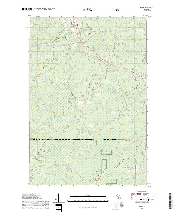
2023 Map of Diffin
USGS Topo · Published 2023About this map
Diffin sits at the junction of several forest roads, serving as a focal point for this heavily wooded landscape at the borders of Alger, Marquette, and Delta Counties. The terrain is defined by an intricate network of waterways, most notably the West Branch Whitefish River which flows past Whitefish Falls. The drainage patterns of Sueker Creek, Werners Creek, and Deadhorse Creek illustrate the low-lying, often marshy nature of the Upper Peninsula interior. Much of the southern portion of the map is dedicated to the Hiawatha NF, where the absence of dense settlement highlights the area's role as a protected timber and recreation resource. Roadways like the Whitefish Grade Rd suggest the historical importance of logging transport in shaping the local geography between these three northern Michigan counties.
Find a feature on this map
35 named features on this map. Tap any name to fly to it.
Don’t see what you’re looking for? This feature index may not catch every label — zoom into the map to look around manually.
Map Details
Editions of this 2023 Diffin Map
This is the sole edition of this map. No revisions or reprints were ever made.
Other maps of this area

1932 · Skandia SW
USGS Topo · 1:31,680

1932 · Rock SW
USGS Topo · 1:31,680

1932 · Trenary SW
USGS Topo · 1:31,680

1932 · Rock NE
USGS Topo · 1:31,680

1932 · Skandia SE
USGS Topo · 1:31,680

1932 · Rock SE
USGS Topo · 1:31,680

1932 · Rock NW
USGS Topo · 1:31,680

1958 · Trenary
USGS Topo · 1:62,500

1958 · Au Train
USGS Topo · 1:62,500

1958 · Skandia
USGS Topo · 1:62,500