2022 Map of Dike
USGS Topo · Published 2022About this map
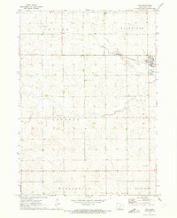
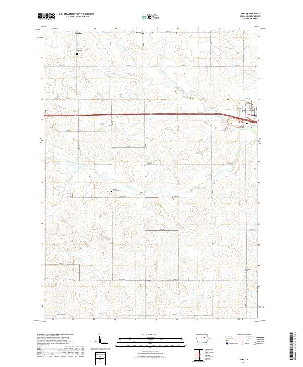
The town of Dike anchors the northeastern corner of this Grundy County landscape, where the agricultural grid is deeply etched by the winding courses of N Fork Black Hawk Cr and S Fork Black Hawk Cr. This modern survey reveals a highly organized rural structure, dotted with significant genealogical markers such as Elmwood Cem and Beaver Township Cem. The small settlements of Swanton and Sinclair reflect the persistent township-based organization of the region. Outside the primary town limits, the terrain is defined by a dense network of numbered county roads and the Dike Trl, indicating a landscape that balances traditional farming operations with local recreation. To the south, Willow Cr and Grant Township Cem further illustrate the distribution of early community landmarks across the prairie.
Find a feature on this map
31 named features on this map. Tap any name to fly to it.
Don’t see what you’re looking for? This feature index may not catch every label — zoom into the map to look around manually.
Map Details
Editions of this 2022 Dike Map
This is the sole edition of this map. No revisions or reprints were ever made.