Old Maps of Grundy County, Iowa
Explore 116 old maps of Grundy County, spanning from 1954 to today. These high-resolution historic maps reveal how streets, neighborhoods, landmarks, and natural features evolved over time — perfect for genealogy, metal detecting, research, and local history exploration.
What you can do with these maps:
- See how Grundy County changed over time: Compare historical maps to modern-day views to trace roads, homesites, rail lines & more.
- View detailed metadata: Each map includes creators, publishers, year, scale, and archive source.
- Overlay maps with satellite & LiDAR: Visualize the past alongside modern tools to explore terrain & human change.
- Trusted historical sources: Maps sourced from the USGS, Library of Congress, and other archives.
- Access maps your way: View online, download high-res files, or order prints for personal or research use.
Start exploring old maps of Grundy County to uncover forgotten places, hidden landmarks, and the deep history beneath your feet.
Grundy County, IA maps
(116)- 1954 Map of Waterloo, 1968 Print
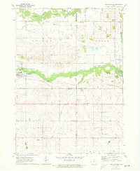
 1954 Waterloo1968 Print · USGSCentral Iowa at the height of its mid-century agricultural and rail boom features the growing hubs of Waterloo and Cedar Falls. Genealogists and researchers can trace the rail corridors of the Chicago Great Western and find local landmarks like Iowa State College and Brushy Ridge.4 unique versions available
 - 1955 Map of Waterloo
 1955 Waterloo1955 Print · USGSCentral Iowa in the mid-fifties presents a dense landscape of rail-connected farming towns and growing river cities. Researchers can trace ancestral roots and old transport routes through Waterloo, Marshalltown, and Ames, while locating rural Cemeteries and local Quarries.2 unique versions available
 - 1960 Map of Marshalltown, 1962 Print
 1960 Marshalltown1962 Print · USGSIn the early 1960s, Marshalltown stood as a bustling rail and manufacturing center along the Iowa River. Genealogists can trace family names through several historic sites, including Riverside Cem, Rose Hill Memorial Gardens, and the rural Prairieville Cem.2 unique versions available
 - 1960 Map of Conrad West, 1966 Print
 1960 Conrad West1966 Print · USGSThe Grundy and Marshall county line in the early sixties is defined by the intersection of rail and stream. Genealogists and researchers can trace local land patterns through Conrad, the Prairieville Cem, and the industrial Quarry site.2 unique versions available
 - 1960 Map of Conrad East, 1966 Print
 1960 Conrad East1966 Print · USGSMid-century Marshall County agriculture and commerce meet in this survey of the Grundy and Tama county borders. Genealogists and historians can trace the paths of the Chicago and North Western rail line through Beaman and locate family sites at Vienna Cem or Oakland Cem.
 - 1971 Map of Zaneta, 1973 Print
 1971 Zaneta1973 Print · USGSThe rural border of Grundy and Black Hawk Counties is captured here in the early seventies, showcasing a landscape of fertile creek bottoms and rail-side settlements. Researchers can locate family landmarks like St Marys Cemetery, the crossroads at Fredsville, and the Zaneta rail stop.
 - 1971 Map of Dike, 1973 Print
 1971 Dike1973 Print · USGSThe agricultural landscape of Grundy County is captured here in the early 1970s, centered on the railroad town of Dike. Genealogists can locate important regional landmarks like Lincoln Center Ch, Elmwood Cem, and the tracks of the Chicago and North Western.
 - 1971 Map of Lincoln, 1973 Print
 1971 Lincoln1973 Print · USGSThe Grundy and Tama County border comes alive in the early seventies, centered on the rural rail towns of Lincoln and Morrison. Trace family roots near Township Cem or follow the competing lines of the Rock Island and North Western railroads.
 - 1971 Map of Stout, 1973 Print
 1971 Stout1973 Print · USGSButler and Grundy Counties appear here in the early 1970s as a landscape shaped by competing railroads and winding prairie waterways. Genealogists and local historians can trace family ties at Beaver Grove Cem and follow the routes of the Illinois Central through Stout and New Hartford.
 - 1971 Map of Reinbeck, 1973 Print
 1971 Reinbeck1973 Print · USGSAgricultural life in Grundy and Tama counties reached a mid-century peak as railroads still connected the prairie townships. Genealogists and historians can trace family plots at Amity Cem and Lincoln Cem, or follow the rail lines through Reinbeck and Dinsdale.
 - 1971 Map of New Hartford, 1973 Print
 1971 New Hartford1973 Print · USGSThe Butler and Black Hawk county lines meet near New Hartford during the early seventies, showcasing a classic Iowa landscape of rail-fed towns and river bottoms. Genealogists can locate several local burial sites like Hillcrest Cem and Fairfield Cem along the farm roads.
 - 1975 Map of Union, 1978 Print
 1975 Union1978 Print · USGSHardin and Marshall counties meet along the winding Iowa River in the mid-seventies, where agriculture and rail lines define the landscape. Genealogists can trace family roots through several local burial sites like Union Cem, Bangor Cem, and Gaer-Ballard Cem.
 - 1979 Map of Grundy Center, 1980 Print
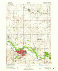
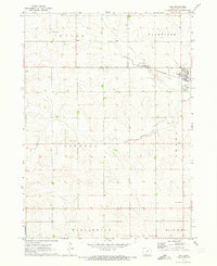
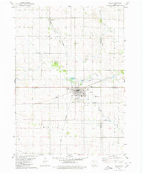
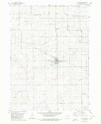
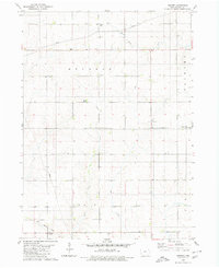
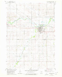
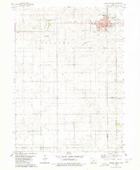 1979 Grundy Center1980 Print · USGSIn the late 1970s, this central Iowa landscape centers on the bustling county seat and its surrounding farm townships. Genealogists and historians can trace the Chicago and North Western rail corridor or locate family sites near Township Cem and Black Hawk Creek.
 - 1979 Map of Holland, 1980 Print
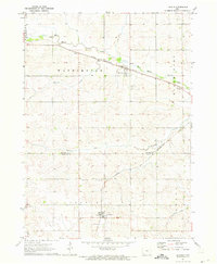
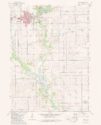
 1979 Holland1980 Print · USGSGrundy County, Iowa, is captured here in the late seventies, showing a classic Midwestern landscape of structured townships and rail-oriented settlements. Genealogists and local historians can locate community centers like Colfax Center Ch, the town of Holland, and the Chicago Rock Island and Pacific rail line.
 - 1979 Map of Ackley, 1980 Print
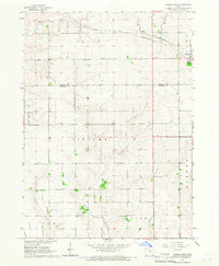
 1979 Ackley1980 Print · USGSThe rural borders of four Iowa counties converge here in the late seventies, centered on a busy regional rail hub. Genealogists and local historians can locate family sites at Blakes Grove (Chapel), Oak Wood Cem, and the small settlement of Faulkner.
 - 1979 Map of Steamboat Rock, 1980 Print
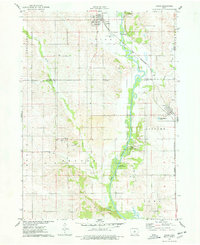
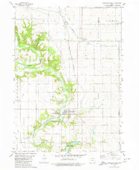 1979 Steamboat Rock1980 Print · USGSThe Hardin and Grundy county line comes alive in the late 1970s as the Iowa River winds through a series of conservation areas. You can trace family roots at Hazel Green Cem or follow the historic tracks of the Chicago and North Western railroad near Abbott.
 - 1979 Map of Eldora, 1980 Print
 1979 Eldora1980 Print · USGSHardin County's river valley comes into sharp focus in the late 1970s, centered on the county seat and its surrounding townships. Researchers can trace rural lineages through family-named landmarks like Sheppard Cem and explore the site of the State Training School for Boys.
 - 1980 Map of Aplington
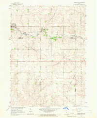
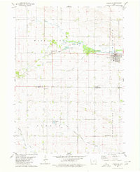 1980 Aplington1980 Print · USGSThe Butler and Grundy county line comes alive in this 1980s-era survey, where the Illinois Central Gulf railroad links the towns of Aplington and Austinville. Trace family history through landmarks like Westfriesland Ch and Excelsior Sch.
 - 1980 Map of Wellsburg
 1980 Wellsburg1980 Print · USGSGrundy County farmland and the railroad town of Wellsburg are captured here during the 1980s. Genealogists and local historians can locate family landmarks such as Timothy Sch, St Pauls Ch, and the Shiloh Cem.
 - 1980 Map of Ivester
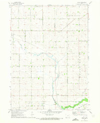
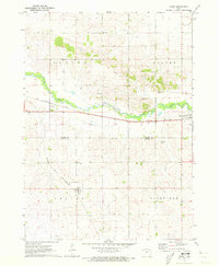
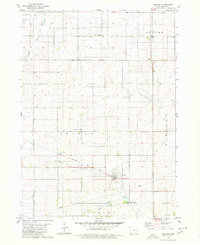
 1980 Ivester1980 Print · USGSGrundy County farmland in the 1970s is meticulously captured here, showing the rural settlement patterns and local townships. Researchers can locate family burial sites at Sheller Cem and Alice Union Cem or trace the path of the Old Railroad Grade.
 - 1980 Map of Parkersburg
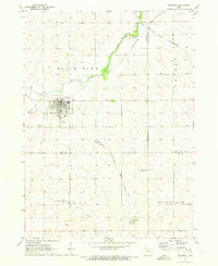
 1980 Parkersburg1980 Print · USGSButler County and Grundy County agricultural life is captured here in the late twentieth century, centered on the rail junction at Parkersburg. Researchers can trace old family plots at Oak Hill Cem or locate the rural Salem Ch and Buck Grove settlement.
 - 1984 Map of Marshalltown, 1985 Print
 1984 Marshalltown1985 Print · USGSMid-Iowa's agricultural landscape and river corridors come alive in the mid-eighties as the Cedar River connects industrial hubs and small farm towns. Trace the tracks of the CHICAGO AND NORTHWESTERN or locate local landmarks like Union Grove State Park and Cedar Falls Junction.2 unique versions available
 - 1984 Map of Waverly, 1985 Print
 1984 Waverly1985 Print · USGSNortheast Iowa in the mid-eighties shows a robust network of river towns and rail corridors connecting agricultural centers. Researchers can trace family sites near Garden of Memories Cem or follow the Chicago and North Western line through Janesville and Waverly.2 unique versions available
 - 1984 Map of Iowa Falls, 1985 Print
 1984 Iowa Falls1985 Print · USGSNorth-central Iowa is documented here during the mid-eighties, showing a landscape of traditional rail towns and extensive wildlife management areas. Researchers can trace family history through settlements like Belmond, Dows, and Ackley, or locate landmarks like Beeds Lake State Park.2 unique versions available
 - 1985 Map of Ames
 1985 Ames1985 Print · USGSCentral Iowa's prairie landscape in the mid-eighties shows a well-established network of rail towns and conservation areas. Genealogists and historians can trace the paths of the Lincoln Highway and the Chicago and North Western line connecting Ames, Boone, and Webster City.
Showing maps 1-25 of 116
Top cities of Grundy County
- Grundy Center historical maps
- Reinbeck historical maps
- Dike historical maps
- Conrad historical maps
- Wellsburg historical maps
- Holland historical maps
See more
Frequently asked questions
- What are the different types of historical maps available for Grundy County?
- What is the oldest map of Grundy County?
- Where can I purchase historical maps of Grundy County for my home or office?
- Where can I download high-res historical maps of Grundy County?
- Are there historical topographic maps available for Grundy County?
- Is there historical aerial imagery available for Grundy County?
- Where are historical maps of Grundy County sourced from?