1970s Maps of Grundy County, Iowa
Explore 12 historic maps of Grundy County from the 1970s. These maps offer a rare glimpse into what life looked like during the 1970s — showing old roads, neighborhoods, homes, and landmarks that have changed or disappeared over time.
Whether you're researching your family's past, planning a metal detecting trip, or studying how Grundy County's landscape evolved across the 1970s, these high-resolution maps are a powerful tool for exploring the history of this region.
- Focus on a specific era: All maps on this page are from the 1970s, giving you a focused view of this time period.
- See what’s changed: Compare century-old streets, trails, and buildings to today's modern landscape using overlays and satellite layers.
- Research with precision: Use these maps for genealogy, historical research, land use analysis, or educational projects.
- View, download, or print: Maps are fully viewable online in high resolution, and can be downloaded or printed for your own records.
Start exploring Grundy County's history through authentic maps from the 1970s. This is your window into the past.
Grundy County, IA maps
(12)- 1971 Map of Zaneta, 1973 Print
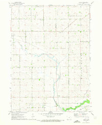 1971 Zaneta1973 Print · USGSThe rural border of Grundy and Black Hawk Counties is captured here in the early seventies, showcasing a landscape of fertile creek bottoms and rail-side settlements. Researchers can locate family landmarks like St Marys Cemetery, the crossroads at Fredsville, and the Zaneta rail stop.
 - 1971 Map of Dike, 1973 Print
 1971 Dike1973 Print · USGSThe agricultural landscape of Grundy County is captured here in the early 1970s, centered on the railroad town of Dike. Genealogists can locate important regional landmarks like Lincoln Center Ch, Elmwood Cem, and the tracks of the Chicago and North Western.
 - 1971 Map of Lincoln, 1973 Print
 1971 Lincoln1973 Print · USGSThe Grundy and Tama County border comes alive in the early seventies, centered on the rural rail towns of Lincoln and Morrison. Trace family roots near Township Cem or follow the competing lines of the Rock Island and North Western railroads.
 - 1971 Map of Stout, 1973 Print
 1971 Stout1973 Print · USGSButler and Grundy Counties appear here in the early 1970s as a landscape shaped by competing railroads and winding prairie waterways. Genealogists and local historians can trace family ties at Beaver Grove Cem and follow the routes of the Illinois Central through Stout and New Hartford.
 - 1971 Map of Reinbeck, 1973 Print
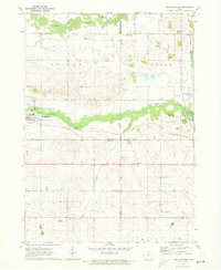
 1971 Reinbeck1973 Print · USGSAgricultural life in Grundy and Tama counties reached a mid-century peak as railroads still connected the prairie townships. Genealogists and historians can trace family plots at Amity Cem and Lincoln Cem, or follow the rail lines through Reinbeck and Dinsdale.
 - 1971 Map of New Hartford, 1973 Print
 1971 New Hartford1973 Print · USGSThe Butler and Black Hawk county lines meet near New Hartford during the early seventies, showcasing a classic Iowa landscape of rail-fed towns and river bottoms. Genealogists can locate several local burial sites like Hillcrest Cem and Fairfield Cem along the farm roads.
 - 1975 Map of Union, 1978 Print
 1975 Union1978 Print · USGSHardin and Marshall counties meet along the winding Iowa River in the mid-seventies, where agriculture and rail lines define the landscape. Genealogists can trace family roots through several local burial sites like Union Cem, Bangor Cem, and Gaer-Ballard Cem.
 - 1979 Map of Grundy Center, 1980 Print
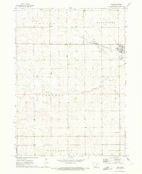
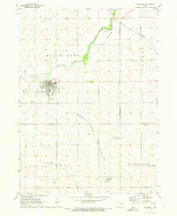
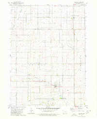
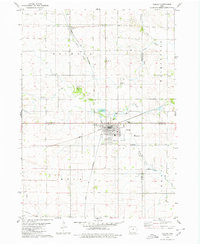
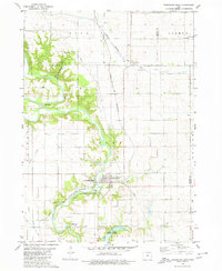
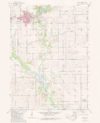
 1979 Grundy Center1980 Print · USGSIn the late 1970s, this central Iowa landscape centers on the bustling county seat and its surrounding farm townships. Genealogists and historians can trace the Chicago and North Western rail corridor or locate family sites near Township Cem and Black Hawk Creek.
 - 1979 Map of Holland, 1980 Print
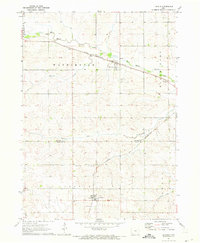
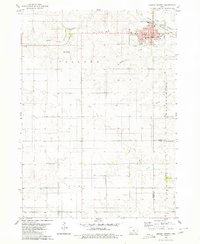
 1979 Holland1980 Print · USGSGrundy County, Iowa, is captured here in the late seventies, showing a classic Midwestern landscape of structured townships and rail-oriented settlements. Genealogists and local historians can locate community centers like Colfax Center Ch, the town of Holland, and the Chicago Rock Island and Pacific rail line.
 - 1979 Map of Ackley, 1980 Print
 1979 Ackley1980 Print · USGSThe rural borders of four Iowa counties converge here in the late seventies, centered on a busy regional rail hub. Genealogists and local historians can locate family sites at Blakes Grove (Chapel), Oak Wood Cem, and the small settlement of Faulkner.
 - 1979 Map of Steamboat Rock, 1980 Print
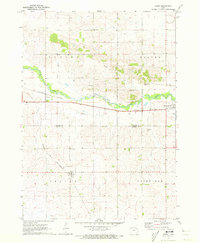
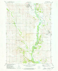
 1979 Steamboat Rock1980 Print · USGSThe Hardin and Grundy county line comes alive in the late 1970s as the Iowa River winds through a series of conservation areas. You can trace family roots at Hazel Green Cem or follow the historic tracks of the Chicago and North Western railroad near Abbott.
 - 1979 Map of Eldora, 1980 Print
 1979 Eldora1980 Print · USGSHardin County's river valley comes into sharp focus in the late 1970s, centered on the county seat and its surrounding townships. Researchers can trace rural lineages through family-named landmarks like Sheppard Cem and explore the site of the State Training School for Boys.
End of results
Showing maps 1-12 of 12
Top cities of Grundy County
- Grundy Center historical maps
- Reinbeck historical maps
- Dike historical maps
- Conrad historical maps
- Wellsburg historical maps
- Holland historical maps
See more
Frequently asked questions
- What are the different types of historical maps available for Grundy County?
- What is the oldest map of Grundy County?
- Where can I purchase historical maps of Grundy County for my home or office?
- Where can I download high-res historical maps of Grundy County?
- Are there historical topographic maps available for Grundy County?
- Is there historical aerial imagery available for Grundy County?
- Where are historical maps of Grundy County sourced from?