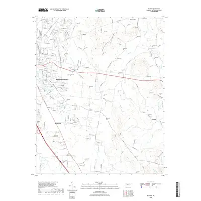
2019 Map of Dillton
USGS Topo · Published 2019About this map
Murfreesboro and its eastern outskirts characterize this 2019 survey, showing the transition from dense urban development to the karst landscapes of the Central Basin. The Flat Rock Cedar Glade And Barrens stands out as a significant natural area northeast of the city, while the rural landscape to the south is dotted with established settlements like Dillton and Mankinville. This geography is defined by the drainage of Lytle Cr and the Middle Fork Stones River, which have historically shaped local land use and transportation routes like the Lascassas Pike. For family historians, the area is rich with family-named burial grounds, including the Elam-Snell Cem, Hallyburton Cem, and Howland Cem. The presence of Fox Camp Spring and Double Spring highlights the hydrogeology that once dictated the placement of pioneer homesteads and early communities across Rutherford County.
Find a feature on this map
186 named features on this map. Tap any name to fly to it.
Don’t see what you’re looking for? This feature index may not catch every label — zoom into the map to look around manually.
Map Details
Editions of this 2019 Dillton Map
This is the sole edition of this map. No revisions or reprints were ever made.
Other maps of this area

1908 · Woodbury
USGS Topo · 1:62,500

1913 · Hollow Springs
USGS Topo · 1:62,500

1916 · Murfreesboro
USGS Topo · 1:62,500

1936 · Webbs Jungle
USGS Topo · 1:24,000

1936 · Beech Grove
USGS Topo · 1:24,000

1936 · Fosterville
USGS Topo · 1:24,000

1942 · Statesville
USGS Topo · 1:100,000

1942 · Lebanon
USGS Topo · 1:100,000

1943 · Mc Minnville
USGS Topo · 1:100,000

1944 · Shelbyville
USGS Topo · 1:100,000