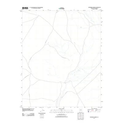
2011 Map of Dinnebito Spring
USGS Topo · Published 2011About this map
Dinnebito Spring and Hock Spring stand as critical water sources in this arid expanse of Coconino County, where the landscape is defined by its remote transportation network. This 2011 survey by the U.S. Geological Survey illustrates the vital infrastructure of the region, anchored by the Hopi Reservation Rd and several numbered tribal routes. The map documents a sparsely populated but geographically significant area, tracing the pathways of Indian Rte 58 and Indian Rte 3 as they navigate the plateau terrain. Unlike older historical surveys that might focus on emerging settlements, this modern topographic study captures the contemporary alignment of roads like Indian Rte 6722 and Indian Rte 6720, providing a precise record of the land's hydrology and transit corridors within the reservation boundaries.
Find a feature on this map
7 named features on this map. Tap any name to fly to it.
Don’t see what you’re looking for? This feature index may not catch every label — zoom into the map to look around manually.
Map Details
Editions of this 2011 Dinnebito Spring Map
This is the sole edition of this map. No revisions or reprints were ever made.
Other maps of this area

1883 · Tusayan
USGS Topo · 1:250,000

1886 · Tusayan
USGS Topo · 1:250,000

1886 · San Francisco Mtns
USGS Topo · 1:250,000

1891 · San Francisco Mtns
USGS Topo · 1:250,000

1894 · San Francisco Mtns
USGS Topo · 1:250,000

1899 · San Francisco Mtns
USGS Topo · 1:250,000

1947 · Flagstaff
USGS Topo · 1:250,000

1954 · Flagstaff
USGS Topo · 1:250,000

1958 · Flagstaff
USGS Topo · 1:250,000

1960 · Flagstaff
USGS Topo · 1:250,000