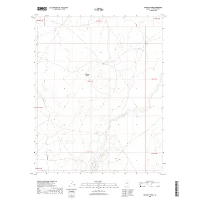
2018 Map of Dinnebito Spring
USGS Topo · Published 2018About this map
Moenkopi Plateau dominates this high desert landscape, characterized by the intricate drainage systems and seasonal water sources essential to the region. The map centers on the namesake Dinnebito Spring, located within a winding canyon system that feeds into Dinnebito Wash. This area is marked by a network of tribal infrastructure, including Indian Rte 3 in the northeast and Indian Rte 6720 in the southwest, reflecting the contemporary transportation routes across Coconino County. Further north, Hock Spring provides another vital water point amidst the terrain's high-elevation flats. The detailed contour lines reveal the complex erosion patterns and mesa edges that define the plateau, illustrating the relationship between the arid environment and its scattered natural springs.
Find a feature on this map
16 named features on this map. Tap any name to fly to it.
Don’t see what you’re looking for? This feature index may not catch every label — zoom into the map to look around manually.
Map Details
Editions of this 2018 Dinnebito Spring Map
This is the sole edition of this map. No revisions or reprints were ever made.
Other maps of this area

1883 · Tusayan
USGS Topo · 1:250,000

1886 · Tusayan
USGS Topo · 1:250,000

1886 · San Francisco Mtns
USGS Topo · 1:250,000

1891 · San Francisco Mtns
USGS Topo · 1:250,000

1894 · San Francisco Mtns
USGS Topo · 1:250,000

1899 · San Francisco Mtns
USGS Topo · 1:250,000

1947 · Flagstaff
USGS Topo · 1:250,000

1954 · Flagstaff
USGS Topo · 1:250,000

1958 · Flagstaff
USGS Topo · 1:250,000

1960 · Flagstaff
USGS Topo · 1:250,000