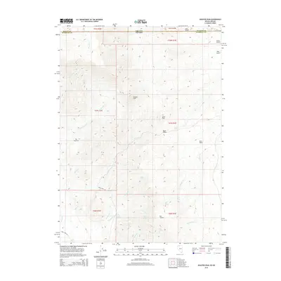
2015 Map of Disaster Peak
USGS Topo · Published 2015About this map
Disaster Peak stands as the central landmark of this high-desert landscape where the borders of Malheur and Harney counties in Oregon meet Humboldt County, Nevada. The terrain is defined by a complex network of drainages, including the headwaters of the Kings River and various forks of Granite Cr and Flat Cr. This 2015 survey reveals an area primarily utilized for ranching and resource management, evidenced by the named springs such as Old Man Spring, Yellow Rose Springs, and Summit Spring that dot the basins. The presence of Horse Creek RD and numerous canyon systems like Basco Canyon and Ikes Canyon suggests a landscape navigated for livestock and rugged travel. Distinctive geological formations like The Granites and Little Peak provide prominent navigation points in a region where water sources are the most significant markers of human and animal activity.
Find a feature on this map
41 named features on this map. Tap any name to fly to it.
Don’t see what you’re looking for? This feature index may not catch every label — zoom into the map to look around manually.
Map Details
Editions of this 2015 Disaster Peak Map
This is the sole edition of this map. No revisions or reprints were ever made.
Other maps of this area

1886 · Disaster
USGS Topo · 1:250,000

1893 · Disaster
USGS Topo · 1:250,000

1954 · Vya
USGS Topo · 1:250,000

1955 · Adel
USGS Topo · 1:250,000

1957 · Adel
USGS Topo · 1:250,000

1958 · Vya
USGS Topo · 1:250,000

1958 · Adel
USGS Topo · 1:250,000

1961 · Trident Peak
USGS Topo · 1:62,500

1961 · Disaster Peak
USGS Topo · 1:62,500

1962 · Vya
USGS Topo · 1:250,000