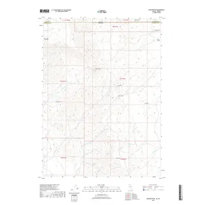
2018 Map of Disaster Peak
USGS Topo · Published 2018About this map
Disaster Peak dominates this high-elevation landscape where the Trout Creek Mountains straddle the state line between Oregon and Nevada. The map captures a complex drainage system feeding the Kings River, defined by the converging forks of W Fork Granite Cr and E Fork Granite Cr, as well as the headwaters of Johnny Cr and China Cr. A network of high-desert water sources is mapped here, including Arristu Spring, Yellow Rose Springs, and the aptly named Old Man Spring. Notable landforms such as The Granites and Little Peak rise above deep carvings like Basco Canyon and Ikes Canyon, illustrating a terrain where seasonal water and elevation dictate the movement of people and livestock. This 2018 survey provides an essential record of the Malheur County backcountry before modern shifts in land use or nomenclature.
Find a feature on this map
38 named features on this map. Tap any name to fly to it.
Don’t see what you’re looking for? This feature index may not catch every label — zoom into the map to look around manually.
Map Details
Editions of this 2018 Disaster Peak Map
This is the sole edition of this map. No revisions or reprints were ever made.
Other maps of this area

1886 · Disaster
USGS Topo · 1:250,000

1893 · Disaster
USGS Topo · 1:250,000

1954 · Vya
USGS Topo · 1:250,000

1955 · Adel
USGS Topo · 1:250,000

1957 · Adel
USGS Topo · 1:250,000

1958 · Vya
USGS Topo · 1:250,000

1958 · Adel
USGS Topo · 1:250,000

1961 · Trident Peak
USGS Topo · 1:62,500

1961 · Disaster Peak
USGS Topo · 1:62,500

1962 · Vya
USGS Topo · 1:250,000