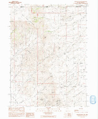
1991 Map of Disaster Peak
USGS Topo · Published 1991About this map
Disaster Peak dominates the northern reaches of the Kings River Valley in this remote section of the Great Basin where the Oregon Nevada state line divides the high desert. The landscape is defined by the high-elevation Trout Creek Mountains and the dramatic rock formations known as The Granites. Water is the critical factor for life and industry here, evidenced by the numerous named water sources like Arristu Spring, Yellow Rose Springs, and Old Man Spring that dot the arid canyons. The drainage of East Fork Granite Creek and Bull Basin Creek shapes the topography, directing flow toward the valley floor.
Find a feature on this map
41 named features on this map. Tap any name to fly to it.
Don’t see what you’re looking for? This feature index may not catch every label — zoom into the map to look around manually.
Map Details
Editions of this 1991 Disaster Peak Map
This is the sole edition of this map. No revisions or reprints were ever made.
Other maps of this area

1886 · Disaster
USGS Topo · 1:250,000

1893 · Disaster
USGS Topo · 1:250,000

1954 · Vya
USGS Topo · 1:250,000

1955 · Adel
USGS Topo · 1:250,000

1957 · Adel
USGS Topo · 1:250,000

1958 · Vya
USGS Topo · 1:250,000

1958 · Adel
USGS Topo · 1:250,000

1961 · Trident Peak
USGS Topo · 1:62,500

1961 · Disaster Peak
USGS Topo · 1:62,500

1962 · Vya
USGS Topo · 1:250,000