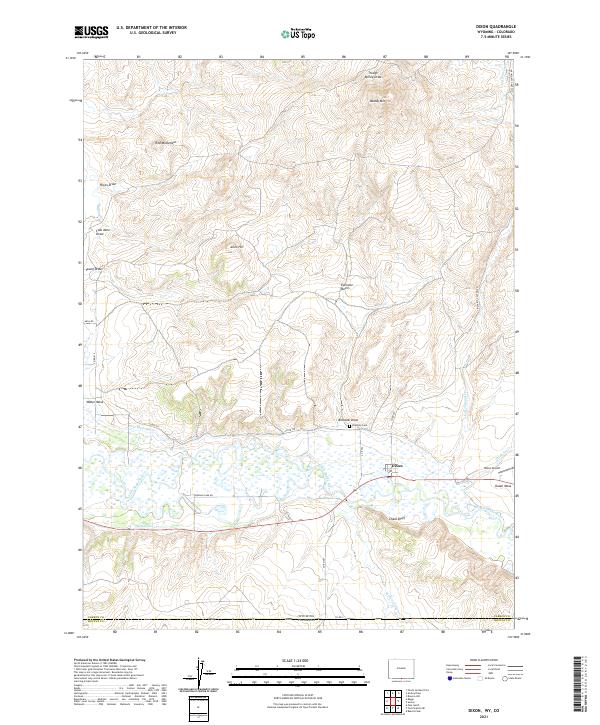
2021 Map of Dixon
USGS Topo · Published 2021About this map
The Little Snake River valley defines this high-desert landscape on the Wyoming-Colorado border, where irrigation infrastructure like the W Side Canal and First Mesa Ditch supports local agriculture. The settlement of Dixon serves as the primary hub, situated near the riverbanks and the Dixon Airport. Topographical features such as Chalk Bluff and Dolan Mesa rise above the river valley, while the northern terrain is characterized by a series of named drainages and landmarks including Red Monument and Eversole Basin. For genealogists, the Eversole Cem is a significant site located near Burbank Draw, reflecting the early families who settled this arid ranching country. The map illustrates a landscape of high mesas and deep draws, including Coal Mine Draw and Hicox Draw, which historically influenced the movement of livestock and people through the region.
Find a feature on this map
36 named features on this map. Tap any name to fly to it.
Don’t see what you’re looking for? This feature index may not catch every label — zoom into the map to look around manually.
Map Details
Editions of this 2021 Dixon Map
This is the sole edition of this map. No revisions or reprints were ever made.
Other maps of this area

1916 · Craig
USGS Topo · 1:125,000

1932 · Savery
USGS Topo · 1:96,000

1940 · Savery
USGS Topo · 1:125,000

1954 · Rawlins
USGS Topo · 1:250,000

1954 · Craig
USGS Topo · 1:250,000

1957 · Craig
USGS Topo · 1:250,000

1957 · Baggs
USGS Topo · 1:62,500

1958 · Rawlins
USGS Topo · 1:250,000

1958 · Craig
USGS Topo · 1:250,000

1960 · Craig
USGS Topo · 1:250,000