Old Maps of Moffat County, Colorado
Explore 760 old maps of Moffat County, spanning from 1885 to today. These high-resolution historic maps reveal how streets, neighborhoods, landmarks, and natural features evolved over time — perfect for genealogy, metal detecting, research, and local history exploration.
What you can do with these maps:
- See how Moffat County changed over time: Compare historical maps to modern-day views to trace roads, homesites, rail lines & more.
- View detailed metadata: Each map includes creators, publishers, year, scale, and archive source.
- Overlay maps with satellite & LiDAR: Visualize the past alongside modern tools to explore terrain & human change.
- Trusted historical sources: Maps sourced from the USGS, Library of Congress, and other archives.
- Access maps your way: View online, download high-res files, or order prints for personal or research use.
Start exploring old maps of Moffat County to uncover forgotten places, hidden landmarks, and the deep history beneath your feet.
Moffat County, CO maps
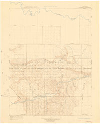
(760)- 1885 Map of Ashley
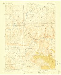
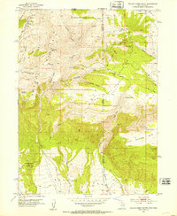
 1885 Ashley1885 Print · USGSThe Uinta Basin in the mid-1880s was a landscape defined by the winding Green River and the high peaks of the eastern Uintas. Researchers can trace early outposts like White Rocks and settlements such as Ashley and Ouray.5 unique versions available
 - 1907 Map of Rangely, 1955 Print
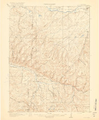
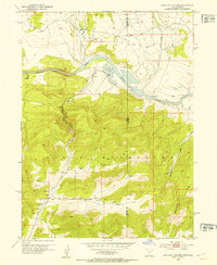
 1907 Rangely1955 Print · USGSNorthwestern Colorado at the turn of the century is captured here in a period of early frontier settlement and reconnaissance. Researchers can trace the river-fed outposts of Rangely and Angora or locate landmarks like Blue Mountain and Raven Park.
 - 1907 Map of Jensen, 1957 Print
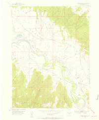
 1907 Jensen1957 Print · USGSEastern Utah and the Colorado borderlands are shown here at the turn of the century as a frontier of river crossings and ranching outposts. Trace the early Stage Road to Dragon or locate the historic Ferry at Jensen near Dinosaur National Monument.
 - 1907 Map of White River, 1957 Print
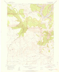
 1907 White River1957 Print · USGSNorthwestern Colorado at the start of the century was a frontier of isolated river valleys and sprawling cattle range. Genealogists can trace early landmarks like Maybell P O, the Keystone Ranch, and the river crossing at Thornburgh Bridge.
 - 1910 Map of Danforth Hills
 1910 Danforth Hills1910 Print · USGSNorthwest Colorado is surveyed here in the early 1900s, showing a landscape defined by the rugged Danforth Hills and the early ranching outposts of Routt and Rio Blanco counties. Genealogists can locate family holdings like Edinger's Ranch and Maudlin's Ranch or trace the early post offices at Lay PO and Hamilton PO.
 - 1910 Map of Jensen
 1910 Jensen1910 Print · USGSThe Utah-Colorado borderlands come alive in the first decade of the twentieth century, showing the early development of the Uinta Basin. Genealogists and historians can locate early river crossings at the ferry sites near Jensen or trace the road to Dragon Stage Road.2 unique versions available
 - 1910 Map of White River
 1910 White River1910 Print · USGSNorthwest Colorado is captured here in the early twentieth century as a landscape of remote river valleys and high plateaus. Local historians can trace early crossings like Thornburgh Bridge and old outposts such as Maybell P O and Keystone Ranch.2 unique versions available
 - 1910 Map of Rangely
 1910 Rangely1910 Print · USGSNorthwestern Colorado at the turn of the century reveals a landscape of isolated outposts and cattle country along the river basins. Genealogists and researchers can trace the early footprints of Rangely, Angora, and Boxelder near the White River.2 unique versions available
 - 1912 Map of Meeker, 1954 Print
 1912 Meeker1954 Print · USGSThe White River valley near Meeker comes alive in the early twentieth century, showing a landscape of pioneer ranching and early rural schooling. Researchers can locate family landmarks like the Uehlein Ranch and trace the footprints of the Powell Park School or Coal Creek School.2 unique versions available
 - 1912 Map of Axial, 1958 Print
 1912 Axial1958 Print · USGSRanching life on Colorado's western slope is captured here just before the First World War, centered on the winding Yampa River. Genealogists can trace early homesteads like K Diamond Ranch and the settlement at Axial.
 - 1914 Map of Meeker
 1914 Meeker1914 Print · USGSThe White River valley in northwestern Colorado appears here just before the First World War, when ranching and small rural schoolhouses defined the landscape. Researchers can trace early family homesteads like Valentine Ranch and James Ranch or locate the Powell Park School.
 - 1914 Map of Axial
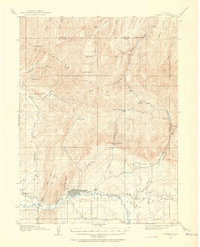
 1914 Axial1914 Print · USGSMoffat County ranching and river life are captured here just before the First World War. Local historians can trace the early Meeker-area landscape through landmarks like Axial, the Juniper Hot Springs, and Duffy Mountain.3 unique versions available
 - 1915 Map of Monument Butte
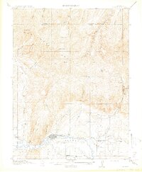
 1915 Monument Butte1915 Print · USGSMoffat County at the start of the Great War was a landscape of high-country ranching and early coal mining. Genealogists and historians can trace family land at Hamilton Ranch or Hart Ranch and locate vanished landmarks like the Morapos School.3 unique versions available
 - 1916 Map of Craig
 1916 Craig1916 Print · USGSMoffat County ranching and the arrival of the railroad define this era before the Great War. Genealogists can trace homesteads like Blevins Ranch and Seicks Ranch, or locate the Lay Valley School and the early Denver and Salt Lake RR line.2 unique versions available
 - 1916 Map of Daton Peak, 1958 Print
 1916 Daton Peak1958 Print · USGSThe Yampa Valley and Williams Fork Mountains are captured here in the mid-1910s during the height of early coal mining. Trace local genealogy and industry through the Cary Mines, the Pagoda School, and the remote Willow Creek Store.2 unique versions available
 - 1920 Map of Daton Peak
 1920 Daton Peak1920 Print · USGSNorthwest Colorado in the era of early mountain ranching and coal mining features a landscape of isolated homesteads and high peaks. Genealogists and historians can trace family-named sites like Jim Dunns Mine, Cary Ranch, and the Pagoda School.2 unique versions available
 - 1923 Map of Elkhead Creek, 1955 Print
 1923 Elkhead Creek1955 Print · USGSMoffat and Routt counties in the early 1920s reveal a landscape of mountain ranching and coal mining before modern development. Genealogists can trace a network of one-room schoolhouses like Dry Fork School and Elkhead School, or locate old family claims near Seymour Mine.5 unique versions available
 - 1924 Map of Elkhead Creek
 1924 Elkhead Creek1924 Print · USGSNorthwest Colorado in the 1920s was a landscape of remote coal mines and scattered one-room schoolhouses along the Yampa River. Genealogists can trace family roots through numerous sites like Elkhead School, the Seymour Mine, and the Bears Ears Ranger Station.2 unique versions available
 - 1932 Map of Savery
 1932 Savery1932 Print · USGSSouthern Wyoming ranching and mining country meet at the edge of the Rockies in the early thirties. Genealogists and historians can locate rural schools like Ketchum Sch, the operations of Pioneer Coal Co, and the remote Tullis settlement.3 unique versions available
 - 1940 Map of Savery
 1940 Savery1940 Print · USGSThe high country of the Wyoming-Colorado border is captured here as the ranching and forest service outposts of the early twentieth century were becoming established. Researchers can trace the remote Snake River drainage and find historic sites like Tullis, Savery, and the Rambler Ranger Sta.2 unique versions available
 - 1952 Map of Willow Creek Butte, 1953 Print
 1952 Willow Creek Butte1953 Print · USGSThe high desert tri-state border country where Utah, Colorado, and Wyoming meet is captured here in the early fifties. Local historians can trace early exploration routes and water sources like Slippery Jim Spr, Whisky Peak, and several Prospect sites.3 unique versions available
 - 1952 Map of Swallow Canyon, 1953 Print
 1952 Swallow Canyon1953 Print · USGSThe Utah-Colorado borderland comes into focus in the early fifties, where the Green River enters the narrow Swallow Canyon. Researchers can trace the rugged terrain of the Uinta Mountains and find local landmarks like Marshall and Crouse Creek.5 unique versions available
 - 1954 Map of Lodore School, 1955 Print
 1954 Lodore School1955 Print · USGSBrowns Park in the mid-1950s reveals a ranching landscape defined by the winding Green River and its fertile bottomlands. Genealogists and historians can trace the locations of family-named sites like Two Bar Ranch, the Lodore School, and several early homesteads marked as abandoned.6 unique versions available
 - 1954 Map of Hells Canyon, 1955 Print
 1954 Hells Canyon1955 Print · USGSMoffat County's canyon country in the mid-fifties was a landscape of remote ranching outposts and ancient riverbeds. Researchers can trace the Mantle Ranch homestead, find the Mantle Sch, or locate the Fred Wall Place (Aband).5 unique versions available
 - 1954 Map of Canyon of Lodore South, 1955 Print
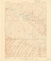
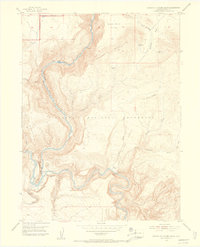 1954 Canyon of Lodore South1955 Print · USGSThe confluence of the Green and Yampa rivers comes to life in this mid-fifties survey of the high desert plateau. Genealogists and historians can trace remote western outposts like Massey Cabin, Buffham Place, and the legendary Echo Park (Pats Hole).5 unique versions available
Showing maps 1-25 of 760
Top cities of Moffat County
Frequently asked questions
- What are the different types of historical maps available for Moffat County?
- What is the oldest map of Moffat County?
- Where can I purchase historical maps of Moffat County for my home or office?
- Where can I download high-res historical maps of Moffat County?
- Are there historical topographic maps available for Moffat County?
- Is there historical aerial imagery available for Moffat County?
- Where are historical maps of Moffat County sourced from?