1960s Maps of Moffat County, Colorado
Explore 89 historic maps of Moffat County from the 1960s. These maps offer a rare glimpse into what life looked like during the 1960s — showing old roads, neighborhoods, homes, and landmarks that have changed or disappeared over time.
Whether you're researching your family's past, planning a metal detecting trip, or studying how Moffat County's landscape evolved across the 1960s, these high-resolution maps are a powerful tool for exploring the history of this region.
- Focus on a specific era: All maps on this page are from the 1960s, giving you a focused view of this time period.
- See what’s changed: Compare century-old streets, trails, and buildings to today's modern landscape using overlays and satellite layers.
- Research with precision: Use these maps for genealogy, historical research, land use analysis, or educational projects.
- View, download, or print: Maps are fully viewable online in high resolution, and can be downloaded or printed for your own records.
Start exploring Moffat County's history through authentic maps from the 1960s. This is your window into the past.
Moffat County, CO maps
(89)- 1960 Map of Craig
 1960 Craig1960 Print · USGSNorthwest Colorado in the 1950s is a landscape of mountain summits and industrial growth at the headwaters of the West. Genealogists and historians can trace rail-town development along the Denver and Salt Lake line, while locating Uranium Mines and settlements like Craig, Meeker, and Steamboat Springs.
 - 1960 Map of Vernal
 1960 Vernal1960 Print · USGSNortheastern Utah was a rugged frontier of mineral extraction and federal conservation in the mid-twentieth century. Genealogists and historians can trace the growth of Vernal, locate Gilsonite mining operations near Bonanza, and explore the 1950s boundaries of Dinosaur National Monument.
 - 1960 Map of Elk Springs, 1962 Print
 1960 Elk Springs1962 Print · USGSNorthwestern Colorado rangelands come into focus at the dawn of the 1960s, showing the intersection of river canyons and remote cattle country. Researchers can trace the heritage of local land use through family-named sites like White Bear Ranch and Rinker Ranch near the Yampa River.4 unique versions available
 - 1960 Map of Lone Mountain, 1963 Print
 1960 Lone Mountain1963 Print · USGSMoffat County ranching culture and high desert terrain are mapped here in the early sixties. Researchers can locate remote outposts like Sand Wash Ranch and family landmarks such as Tindell Ranch or Sheridan Ranch.3 unique versions available
 - 1961 Map of Savery, 1963 Print
 1961 Savery1963 Print · USGSThe Little Snake River valley at the Wyoming-Colorado border is documented here in the early sixties. Genealogists and local historians can locate the Baker Cem and Reader Cem, while tracing the rural footprints of Savery and Slater.3 unique versions available
 - 1961 Map of Grieve Reservoir, 1963 Print
 1961 Grieve Reservoir1963 Print · USGSThe high-country ranching borderlands of Carbon County appear here in the early sixties as the Missouri River Basin development program reached into the Rockies. Genealogists and historians can locate the Battle Creek Sch and Anderson Cem along the Little Snake River, alongside landmarks like the Boyer Ranch.2 unique versions available
 - 1962 Map of Rawlins
 1962 Rawlins1962 Print · USGSSouthern Wyoming at the dawn of the sixties shows a landscape shaped by the Union Pacific and the high peaks of the Medicine Bow Mountains. Researchers can trace the path of the old stage routes through Overland Stage Station and Fort Fred Steele.
 - 1962 Map of Rock Springs
 1962 Rock Springs1962 Print · USGSThe high desert of Sweetwater County in the early 1960s reveals a rugged ranching and energy landscape centered on Rock Springs. Genealogists can trace family holdings like the Erikson-Kent Ranch and Barnhart Ranch alongside the Union Pacific line.
 - 1962 Map of Craig
 1962 Craig1962 Print · USGSNorthwest Colorado in the early sixties is a land of high-elevation ranching and remote river valleys. Genealogists and historians can trace the Denver and Rio Grande Western rail lines and locate early settlements like Hahns Peak, Meeker, and Juniper Springs.
 - 1962 Map of Lazy Y Point, 1965 Print
 1962 Lazy Y Point1965 Print · USGSMoffat County's high plateaus are shown in the early sixties as a landscape of remote camps and essential water sources. Researchers can trace the layout of the Lazy Y Summer Camp, find landmarks like Arapahoe Rock, or locate seasonal springs such as Birch Spring.4 unique versions available
 - 1962 Map of Tanks Peak, 1965 Print
 1962 Tanks Peak1965 Print · USGSNorthwestern Colorado canyon country in the early sixties remains a frontier of isolated homesteads and mining claims within Dinosaur National Monument. Genealogists and historians can locate legacy structures like Baker and Hamlin cabins near sites like Mantle Mine.2 unique versions available
 - 1962 Map of Rangely NE, 1965 Print
 1962 Rangely NE1965 Print · USGSRio Blanco and Moffat counties were centers of industrial exploration in the early 1960s. Researchers can trace the footprint of the Rangely Oil Field and numerous water features like Burning Mine Reservoir and Spooky Mountain.2 unique versions available
 - 1962 Map of Cactus Reservoir, 1965 Print
 1962 Cactus Reservoir1965 Print · USGSThe Rio Blanco and Moffat County borderlands appear in the early sixties as a rugged intersection of industrial mining and desert water management. Researchers can locate the Staley-Gordon Mine on the White River or trace trails across Hatch Flats and Coal Ridge.2 unique versions available
 - 1962 Map of Mellen Hill, 1965 Print
 1962 Mellen Hill1965 Print · USGSNorthwestern Colorado’s high desert meets mid-century industrial expansion in the early sixties. Trace the intersection of protected land at Dinosaur National Monument with the oil infrastructure of Rangel Field and Raven Ridge.
 - 1962 Map of Plug Hat Rock, 1965 Print
 1962 Plug Hat Rock1965 Print · USGSHigh desert plateaus and remote mountain cabins define this Moffat County landscape in the early sixties. Researchers can trace historic homestead sites like Haslem Cabin or Morgan Cabin and follow the high route of Harpers Corner Road past Plug Hat Rock.
 - 1962 Map of Divide Creek, 1965 Print
 1962 Divide Creek1965 Print · USGSThe White River valley in the early sixties was a landscape defined by water management and mineral potential. Researchers can trace early ranching infrastructure through Divide Creek Detention Dam and settlements like Angora.2 unique versions available
 - 1962 Map of M F Mountain, 1965 Print
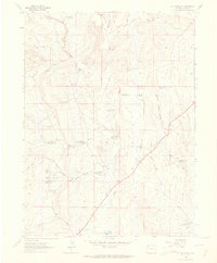 1962 M F Mountain1965 Print · USGSMoffat County ranching culture is preserved here in the early 1960s, showing the high-country landscape before modern developments. Researchers can locate remote family sites like the Bar 71 Ranch, Mobley Place, and a small local Cem.3 unique versions available
 - 1962 Map of Skull Creek, 1965 Print
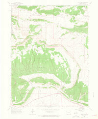 1962 Skull Creek1965 Print · USGSMoffat County ranching and rugged drainages are captured here in the early sixties. Genealogists and local historians can trace family-named landmarks like the Karren Ranch, find an isolated Grave, or locate water sources such as Peterson Reservoir.2 unique versions available
 - 1962 Map of Indian Water Canyon, 1965 Print
 1962 Indian Water Canyon1965 Print · USGSNorthwestern Colorado in the early sixties reveals a landscape of deep river canyons and remote ranching outposts. Researchers can trace historical routes like the Old Chuck Wagon Road and locate isolated sites such as Stubs Cabin and Spurgion Cabins.2 unique versions available
 - 1962 Map of Haystack Rock, 1966 Print
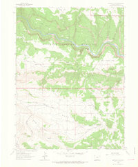 1962 Haystack Rock1966 Print · USGSMoffat County's remote canyonlands are captured here in the early sixties, showing the isolated Mantle Ranch deep within the Dinosaur National Monument. Researchers can trace the winding Yampa River past landmarks like Haystack Rock and find early prospecting sites at Iron Mine Basin.2 unique versions available
 - 1963 Map of Four J Rim, 1966 Print
 1963 Four J Rim1966 Print · USGSHigh desert plateaus and remote drainages define this borderland in the early 1960s. Researchers can locate isolated landmarks like Wallace Cabin or trace water sources through Four J Basin and Pine Lake.2 unique versions available
 - 1963 Map of Red Creek Ranch, 1966 Print
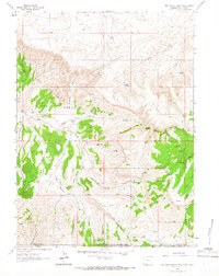 1963 Red Creek Ranch1966 Print · USGSThe tri-state borders of Wyoming, Utah, and Colorado come together in this early 1960s survey of the high desert. Genealogists and local historians can locate remote family outposts like Red Creek Ranch, Meadow Gulch Ranch, and Petes Place among the Red Creek Badlands.2 unique versions available
 - 1963 Map of Scrivner Butte, 1966 Print
 1963 Scrivner Butte1966 Print · USGSRanching and early energy extraction intersect along the Wyoming-Colorado border in the early sixties. Researchers can trace historic family-named sites like Rife Ranch and Scofield Ranch or locate industrial markers including the Canyon Creek Mine.2 unique versions available
 - 1964 Map of Craig
 1964 Craig1964 Print · USGSNorthwestern Colorado's high country is captured here during the mid-sixties, from the Yampa River valley to the high peaks of the Park Range. Local researchers can trace the Denver and Rio Grande Western rail line and locate Uranium Mines near Lay.
 - 1965 Map of Craig
 1965 Craig1965 Print · USGSNorthwest Colorado in the mid-sixties is defined by its massive river basins and high mountain ranges flanking the Continental Divide. Trace the routes of the Denver and Rio Grande Western through old settlements like McCoy and Kremmling.
Showing maps 1-25 of 89
Top cities of Moffat County
Frequently asked questions
- What are the different types of historical maps available for Moffat County?
- What is the oldest map of Moffat County?
- Where can I purchase historical maps of Moffat County for my home or office?
- Where can I download high-res historical maps of Moffat County?
- Are there historical topographic maps available for Moffat County?
- Is there historical aerial imagery available for Moffat County?
- Where are historical maps of Moffat County sourced from?