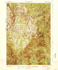
1934 Map of Dixville
USGS Topo · Published 1934About this map
Colebrook and the surrounding townships in northern New Hampshire appear here in a landscape of high ridges and rural valley settlements. The local economy and community life in the early 1930s are clearly marked by an extensive network of schoolhouses, including the Piper Hill Sch, Whittemore Sch, and Grand Vision Sch. These small district schools, along with sites like the East Columbia Ch, highlight the family-centric settlement patterns before the consolidation of rural education.
Find a feature on this map
114 named features on this map. Tap any name to fly to it.
Don’t see what you’re looking for? This feature index may not catch every label — zoom into the map to look around manually.
Map Details
Editions of this 1934 Dixville Map
2 editions found

Other maps of this area

1920 · Guildhall
USGS Topo · 1:62,500

1925 · Indian Stream
USGS Topo · 1:48,000

1926 · Indian Stream
USGS Topo · 1:62,500

1927 · Indian Stream
USGS Topo · 1:62,500

1927 · Second Lake
USGS Topo · 1:62,500

1929 · Averill
USGS Topo · 1:62,500

1930 · Milan
USGS Topo · 1:62,500

1930 · Percy
USGS Topo · 1:62,500

1930 · Dixville
USGS Topo · 1:62,500

1930 · Errol
USGS Topo · 1:62,500